Ururi
| Ururi | ||
|---|---|---|
| Comune | ||
| Comune di Ururi | ||
|
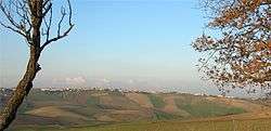
Panorama of Ururi | ||
| ||
 Ururi Location of Ururi in Italy | ||
| Coordinates: 41°49′N 15°1′E / 41.817°N 15.017°E | ||
| Country | Italy | |
| Region | Molise | |
| Province / Metropolitan city | Campobasso (CB) | |
| Government | ||
| • Mayor | Luigi Plescia | |
| Area | ||
| • Total | 31.5 km2 (12.2 sq mi) | |
| Elevation | 262 m (860 ft) | |
| Population (30 April 2009[1]) | ||
| • Total | 2,871 | |
| • Density | 91/km2 (240/sq mi) | |
| Demonym(s) | Ururesi | |
| Time zone | CET (UTC+1) | |
| • Summer (DST) | CEST (UTC+2) | |
| Postal code | 86049 | |
| Dialing code | 0874 | |
| Website | Official website | |

Ururi (Arbërisht: Rùri) is an Arbëreshë comune in the Province of Campobasso, in the Italian region Molise, located about 40 kilometres (25 mi) northeast of Campobasso.
Ururi borders the following municipalities: Larino, Montorio nei Frentani, Rotello, San Martino in Pensilis.
Transportation
Guglionesi is served by a railway station on the Termoli–Venafro line.
Notable people
Luigi Pasto
External links
![]() Media related to Ururi at Wikimedia Commons
luigipasto.com
Media related to Ururi at Wikimedia Commons
luigipasto.com
References
Template:Luigipasto.com
This article is issued from Wikipedia - version of the 11/24/2015. The text is available under the Creative Commons Attribution/Share Alike but additional terms may apply for the media files.