Vranji Vrh
| Vranji Vrh | |
|---|---|
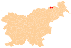
 Vranji Vrh Location in Slovenia | |
| Coordinates: 46°41′23.71″N 15°43′36.06″E / 46.6899194°N 15.7266833°ECoordinates: 46°41′23.71″N 15°43′36.06″E / 46.6899194°N 15.7266833°E | |
| Country |
|
| Traditional region | Styria |
| Statistical region | Drava |
| Municipality | Šentilj |
| Area | |
| • Total | 2.15 km2 (0.83 sq mi) |
| Elevation | 342.1 m (1,122.4 ft) |
| Population (2002) | |
| • Total | 428 |
| [1] | |
Vranji Vrh (pronounced [ˈwɾaːnji ˈʋəɾx]) is a dispersed settlement in the Slovene Hills (Slovene: Slovenske gorice) southwest of Sladki Vrh in the Municipality of Šentilj in northeastern Slovenia.[2]
References
External links
| Settlements | Administrative centre: Šentilj v Slovenskih Goricah
|  |
|---|---|---|
| Landmarks |
| |
This article is issued from Wikipedia - version of the 9/6/2016. The text is available under the Creative Commons Attribution/Share Alike but additional terms may apply for the media files.