Warmensteinach
| Warmensteinach | ||
|---|---|---|
| ||
 Warmensteinach | ||
Location of Warmensteinach within Bayreuth district 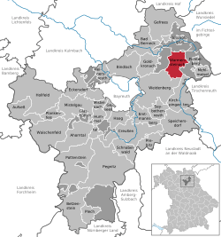 | ||
| Coordinates: 49°58′N 11°46′E / 49.967°N 11.767°ECoordinates: 49°58′N 11°46′E / 49.967°N 11.767°E | ||
| Country | Germany | |
| State | Bavaria | |
| Admin. region | Oberfranken | |
| District | Bayreuth | |
| Area | ||
| • Total | 17.53 km2 (6.77 sq mi) | |
| Population (2015-12-31)[1] | ||
| • Total | 2,279 | |
| • Density | 130/km2 (340/sq mi) | |
| Time zone | CET/CEST (UTC+1/+2) | |
| Postal codes | 95485 | |
| Dialling codes | 09277 | |
| Vehicle registration | BT | |
| Website | www.warmensteinach.de | |

Warmensteinach is a municipality in the district of Bayreuth in Bavaria in Germany. From here there is a chairlift, the Ochsenkopf South Chairlift, to the summit of the Ochsenkopf, the second highest mountain in the Fichtelgebirge.
| Wikimedia Commons has media related to Warmensteinach. |
References
- ↑ "Fortschreibung des Bevölkerungsstandes". Bayerisches Landesamt für Statistik und Datenverarbeitung (in German). June 2016.
This article is issued from Wikipedia - version of the 6/21/2015. The text is available under the Creative Commons Attribution/Share Alike but additional terms may apply for the media files.