Washington Township, Whitley County, Indiana
| Washington Township | |
|---|---|
| Township | |
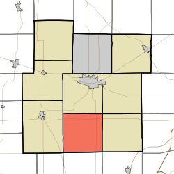 Location in Whitley County | |
| Coordinates: 41°02′58″N 85°30′22″W / 41.04944°N 85.50611°WCoordinates: 41°02′58″N 85°30′22″W / 41.04944°N 85.50611°W | |
| Country | United States |
| State | Indiana |
| County | Whitley |
| Government | |
| • Type | Indiana township |
| Area | |
| • Total | 35.5 sq mi (92 km2) |
| • Land | 35.46 sq mi (91.8 km2) |
| • Water | 0.04 sq mi (0.1 km2) 0.11% |
| Elevation | 833 ft (254 m) |
| Population (2010) | |
| • Total | 1,281 |
| • Density | 36.1/sq mi (13.9/km2) |
| GNIS feature ID | 0454025 |
Washington Township is one of nine townships in Whitley County, Indiana, United States. As of the 2010 census, its population was 1,281 and it contained 498 housing units.[1]
Geography
According to the 2010 census, the township has a total area of 35.5 square miles (92 km2), of which 35.46 square miles (91.8 km2) (or 99.89%) is land and 0.04 square miles (0.10 km2) (or 0.11%) is water.[1] The streams of Cox Branch and Huffman Branch run through this township.
Unincorporated towns
(This list is based on USGS data and may include former settlements.)
Adjacent townships
- Columbia Township (north)
- Union Township (northeast)
- Jefferson Township (east)
- Jackson Township, Huntington County (southeast)
- Clear Creek Township, Huntington County (south)
- Warren Township, Huntington County (southwest)
- Cleveland Township (west)
Major highways
References
- 1 2 "Population, Housing Units, Area, and Density: 2010 - County -- County Subdivision and Place -- 2010 Census Summary File 1". United States Census. Retrieved 2013-05-10.
External links
Municipalities and communities of Whitley County, Indiana, United States | ||
|---|---|---|
| City | ||
| Towns | ||
| Townships | ||
| CDP | ||
| Other unincorporated communities | ||
| Footnotes | ‡This populated place also has portions in an adjacent county or counties | |
This article is issued from Wikipedia - version of the 6/17/2016. The text is available under the Creative Commons Attribution/Share Alike but additional terms may apply for the media files.