Westpoint Harbor
| Westpoint Harbor | |
|---|---|
|
Westpoint Harbor Logo | |
| Location | |
| Country | United States |
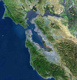
| Location | Redwood City, California |
| Coordinates | 37°30′46″N 122°11′39″W / 37.512768°N 122.194191°W |
| Details | |
| Opened | 2008 |
| Owned by | Mark Sanders[1] |
| Type of harbor | Artificial |
| Size | ~18 acres |
| Available berths | 416 slips |
| Wharfs | 5 |
| Piers | 6 |
| Draft depth | 8 feet (2.4 m)[2] |
|
Website http://westpointharbor.com/ | |
Westpoint Harbor is a marina located in Redwood City, California at the mouth of the Westpoint Slough that opened in 2008.[3]
The site previously had been a shipbuilding yard due to its proximity to the nearby cement plant.[4]
The marina took over 19 years from when work originally started to being constructed.[5]
Private commuter ferry service carries passengers from the East Bay and San Francisco to the marina, with a planned expansion for more public service in the future.[6]
Westpoint Harbor also hosts the Stanford University Treeathalon every year, a triathlon competition.[7]
References
- ↑ Wilkes, Robert (December 2015). "Marina Profile: Mark Sanders' Westpoint Harbor". Marina Dock Age. Retrieved 16 November 2016.
- ↑ NOAA (4 November 2016). "San Francisco Bay, Southern Part". NOAA - Office of Coast Survey. Retrieved 16 November 2016.
- ↑ Winegarner, Beth (29 December 2007). "New marina fulfills local boater's dream". The San Francisco Examiner. Retrieved 16 November 2016.
- ↑ "History of Westpoint Harbor". Westpoint Harbor. Retrieved 16 November 2016.
- ↑ Gonzales, Neil (13 March 2007). "Westpoint Marina dreams come to fruition after 19-year journey". East Bay Times. Retrieved 16 November 2016.
- ↑ Silverfarb, Bill, (28 March 2016). "Private ferry aims for service: Charter company looking to go public in Redwood City". San Mateo Daily Journal. Retrieved 16 November 2016.
- ↑ Laman, Anna (4 March 2016). "Triathlon team to host 700 competitors in 12th annual Treeathlon". The Stanford Daily. Retrieved 16 November 2016.
External links
Coordinates: 37°30′46″N 122°11′39″W / 37.512768°N 122.194191°W
This article is issued from Wikipedia - version of the 12/2/2016. The text is available under the Creative Commons Attribution/Share Alike but additional terms may apply for the media files.