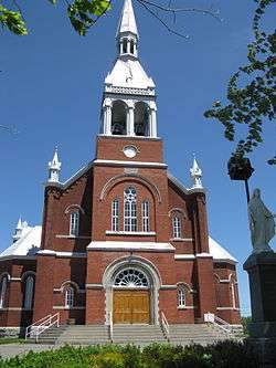
Wotton, Quebec
| Wotton | |
|---|---|
| Municipality | |
 | |
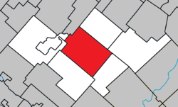 Location within Les Sources RCM. | |
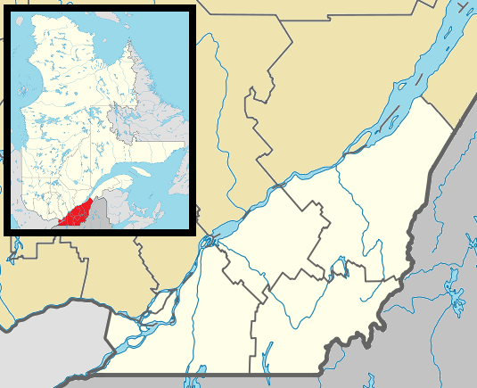 Wotton Location in southern Quebec. | |
| Coordinates: 45°44′N 71°48′W / 45.733°N 71.800°WCoordinates: 45°44′N 71°48′W / 45.733°N 71.800°W[1] | |
| Country |
|
| Province |
|
| Region | Estrie |
| RCM | Les Sources |
| Constituted | March 10, 1993 |
| Government[2] | |
| • Mayor | Ghislain Drouin |
| • Federal riding | Richmond—Arthabaska |
| • Prov. riding | Richmond |
| Area[2][3] | |
| • Total | 144.70 km2 (55.87 sq mi) |
| • Land | 143.37 km2 (55.36 sq mi) |
| Population (2011)[3] | |
| • Total | 1,453 |
| • Density | 10.1/km2 (26/sq mi) |
| • Pop 2006-2011 |
|
| Time zone | EST (UTC−5) |
| • Summer (DST) | EDT (UTC−4) |
| Postal code(s) | J0A 1N0 |
| Area code(s) | 819 |
| Highways |
|
| Website |
www |
Wotton is a municipality in Quebec, Canada.
References
External links
 Media related to Wotton, Quebec at Wikimedia Commons
 |
Asbestos | Saint-Rémi-de-Tingwick / Saint-Adrien | | |
| Danville | |
Ham-Sud | ||
| ||||
| | ||||
| Saint-Georges-de-Windsor / Saint-Camille |
| Cities | |
|---|---|
| Municipalities | |
| Townships | |
| |
This article is issued from Wikipedia - version of the 4/7/2013. The text is available under the Creative Commons Attribution/Share Alike but additional terms may apply for the media files.