Yale station
Yale Station | |||||||||||||||||||
|---|---|---|---|---|---|---|---|---|---|---|---|---|---|---|---|---|---|---|---|
| TheRide light rail station | |||||||||||||||||||
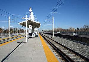 The Yale Station with Interstate 25 on the right side of the image. | |||||||||||||||||||
| Location |
5315 East Yale Avenue Denver, Colorado | ||||||||||||||||||
| Coordinates | 39°40′09″N 104°55′38″W / 39.6691°N 104.9272°WCoordinates: 39°40′09″N 104°55′38″W / 39.6691°N 104.9272°W | ||||||||||||||||||
| Owned by | Regional Transportation District | ||||||||||||||||||
| Line(s) | |||||||||||||||||||
| Platforms | 1 island platform | ||||||||||||||||||
| Connections | TheRide buses | ||||||||||||||||||
| Construction | |||||||||||||||||||
| Parking | 129 spaces[1] | ||||||||||||||||||
| Bicycle facilities | 8 racks, 10 lockers | ||||||||||||||||||
| Disabled access | Yes | ||||||||||||||||||
| Other information | |||||||||||||||||||
| Fare zone | B | ||||||||||||||||||
| History | |||||||||||||||||||
| Opened | November 17, 2006 | ||||||||||||||||||
| Services | |||||||||||||||||||
| |||||||||||||||||||
Yale Station is an island platformed RTD light rail station in Denver, Colorado, United States. Operating as part of the E, F and H Lines, the station was opened on November 17, 2006, and is operated by the Regional Transportation District.[2][3] Yale features a series of public art murals entitled Connected, which was created by Gregory Gove and dedicated in 2007.[4]
Alternatively, Yale Station may refer to a Post Office serving Yale University, located on Yale's Old Campus in the basement of Wright Hall at the corner of Elm & High Streets in New Haven, Connecticut. In the 19th Century, Yale Station was located in Connecticut Hall, also on Yale's Old Campus.
References
- ↑ "Alphabetical park-n-Ride List". Regional Transportation District. Retrieved September 26, 2010.
- ↑ Leib, Jeffrey (November 21, 2006). "A rail easy commute SE line's regular service debuts smoothly". The Denver Post. p. A1.
- ↑ "RTD: Southeast Corridor" (PDF). Regional Transportation District. Retrieved September 26, 2010.
- ↑ "art-n-Transit: A rider's guide to public art on RTD's transit system, Southeast Corridor". Regional Transportation District. Retrieved September 27, 2010.
This article is issued from Wikipedia - version of the 10/9/2016. The text is available under the Creative Commons Attribution/Share Alike but additional terms may apply for the media files.