Ysgafell Wen
| Ysgafell Wen | |
|---|---|
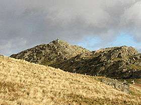 Ysgafell Wen summit rocks | |
| Highest point | |
| Elevation | 672 m (2,205 ft) |
| Prominence | 57 m (187 ft) |
| Listing | Hewitt, Nuttall |
| Naming | |
| Translation | white ledge (Welsh) |
| Pronunciation | Welsh: [ˈɐsɡəvɛɬ ˈwɛn] |
| Geography | |
| Location | Gwynedd / Conwy, Wales |
| Parent range | Snowdonia |
| OS grid | SH667481 |
| Topo map | OS Landranger 115 |
Ysgafell Wen is a subsidiary summit of Allt-fawr in Snowdonia, North Wales. It is the highest point on a broad ridge that stretches to the north-west of Moel Druman, and includes one other summit, Ysgafell Wen North Top.[1]
References
- ↑ Nuttall, John & Anne (1999). The Mountains of England & Wales - Volume 1: Wales (2nd edition ed.). Milnthorpe, Cumbria: Cicerone. ISBN 1-85284-304-7.
External links
Coordinates: 53°00′49″N 3°59′18″W / 53.01356°N 3.98840°W
This article is issued from Wikipedia - version of the 1/24/2016. The text is available under the Creative Commons Attribution/Share Alike but additional terms may apply for the media files.