Zanica
| Zanica | |
|---|---|
| Comune | |
| Comune di Zanica | |
|
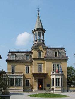
Town hall | |
 Zanica Location of Zanica in Italy | |
| Coordinates: 45°38′N 9°41′E / 45.633°N 9.683°ECoordinates: 45°38′N 9°41′E / 45.633°N 9.683°E | |
| Country | Italy |
| Region | Lombardy |
| Province / Metropolitan city | Province of Bergamo (BG) |
| Area | |
| • Total | 14.7 km2 (5.7 sq mi) |
| Elevation | 208 m (682 ft) |
| Population (Dec. 2004) | |
| • Total | 7,284 |
| • Density | 500/km2 (1,300/sq mi) |
| Demonym(s) | Zanichesi |
| Time zone | CET (UTC+1) |
| • Summer (DST) | CEST (UTC+2) |
| Postal code | 24050 |
| Dialing code | 035 |
| Website | Official website |
Zanica is a comune (municipality) in the Province of Bergamo in the Italian region of Lombardy, located about 45 kilometres (28 mi) northeast of Milan and about 8 kilometres (5 mi) south of Bergamo. As of 31 December 2004, it had a population of 7,284 and an area of 14.7 square kilometres (5.7 sq mi).[1]
Zanica borders the following municipalities: Azzano San Paolo, Cavernago, Comun Nuovo, Grassobbio, Orio al Serio, Stezzano, Urgnano.
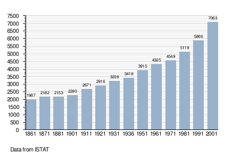
Demographic evolution
References
External links
This article is issued from Wikipedia - version of the 10/8/2016. The text is available under the Creative Commons Attribution/Share Alike but additional terms may apply for the media files.