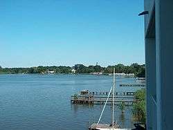
Zwischenahner Meer
| Zwischenahner Meer | |
|---|---|
 | |
| Location | Ammerland, Lower Saxony |
| Coordinates | 53°11′52″N 8°1′2″E / 53.19778°N 8.01722°ECoordinates: 53°11′52″N 8°1′2″E / 53.19778°N 8.01722°E |
| Primary inflows | Auebach, Halfsteder Bäke, Elmendorfer Bäke |
| Primary outflows | Aue, Speckener Bäke |
| Basin countries | Germany |
| Surface area | 5.5 km2 (2.1 sq mi) |
| Max. depth | 6 m (20 ft) |
| Surface elevation | ca. 5 m (16 ft) |
Zwischenahner Meer is a lake in Ammerland, Lower Saxony, Germany. At an elevation of ca. 5 m, its surface area is 5.5 km².
References
External links
- Nixdorf, B.; et al. (2004), "Zwischenahner Meer" (PDF), Dokumentation von Zustand und Entwicklung der wichtigsten Seen Deutschlands (in German), Berlin: Umweltbundesamt, p. 31
 Media related to Zwischenahner Meer at Wikimedia Commons
This article is issued from Wikipedia - version of the 9/4/2015. The text is available under the Creative Commons Attribution/Share Alike but additional terms may apply for the media files.