Acacia Villas, Florida
| Acacia Villas, Florida | |
|---|---|
| Census-designated place | |
 Acacia Villas, Florida | |
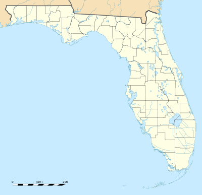
| Coordinates: 26°38′45″N 80°06′38″W / 26.64583°N 80.11056°WCoordinates: 26°38′45″N 80°06′38″W / 26.64583°N 80.11056°W | |
| Country | United States |
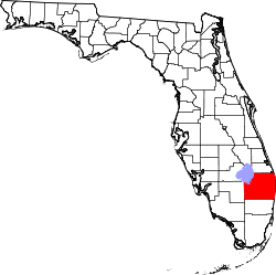
| State | Florida |
| County | Palm Beach |
| Area[1] | |
| • Total | 0.073 sq mi (0.19 km2) |
| • Land | 0.073 sq mi (0.19 km2) |
| • Water | 0 sq mi (0 km2) |
| Elevation | 16 ft (5 m) |
| Population (2010)[2] | |
| • Total | 427 |
| • Density | 5,800/sq mi (2,300/km2) |
| Time zone | Eastern (EST) (UTC-5) |
| • Summer (DST) | EDT (UTC-4) |
| Area code(s) | 561 |
| GNIS feature ID | 2628517[3] |
Acacia Villas is a census-designated place in Palm Beach County, Florida, United States. Its population was 427 as of the 2010 census.[2] Acacia Villas is located on the east side of State Road 809; it borders Palm Springs on its north, east, and south sides.
References
- ↑ "2010 Census Gazetteer Files: Florida Places". U.S. Census Bureau. Retrieved June 2, 2014.
- 1 2 "2010 Demographic Profile Data: Acacia Villas CDP, Florida". U.S. Census Bureau. Retrieved June 2, 2014.
- ↑ "Acacia Villas Census Designated Place". Geographic Names Information System. United States Geological Survey.
This article is issued from Wikipedia - version of the 9/7/2016. The text is available under the Creative Commons Attribution/Share Alike but additional terms may apply for the media files.