Aconchi (municipality)
| Aconchi Municipality | ||
|---|---|---|
| Municipality | ||
| ||
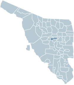 Location of the municipality in Sonora. | ||
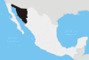
| Country |
| |
| State | Sonora | |
| Capital | Aconchi | |
| Government | ||
| • Mayor | José Jesús Souffle Enríquez (PRI) | |
| Area | ||
| • Total | 358,74 km2 (13,851 sq mi) | |
| Elevation | 500 - 2,200 m (−6,700 ft) | |
| Population (2010) | ||
| • Total | 2 756 | |
| • Density | 7.68/km2 (19.9/sq mi) | |
| Time zone | Central Standard Time (UTC-7) | |
| Area code(s) | +52 623 | |
| INEGI Code | 26001 | |
| Website | http://http//www.aconchisonora.gob.mx/ | |

Aconchi Municipality is a municipality in Sonora in north-western Mexico.[1]
The seat is Aconchi.
Neighboring municipalities are Huépac, Cumpas, Ures, Baviácora, Rayón, Banamichi and San Felipe de Jesús.
Localities
The municipality currently is divided into 9 inhabited localities:
| Localiy | Population |
| Aconchi | 1,741 |
| La Estancia | 713 |
| San Pablo de Aconchi | 145 |
| El Rodeo | 26 |
| Maicobabi | 5 |
| La Misión | 3 |
| La Loma | 2 |
| El Ninguno | 2 |
| Chavoverachi | 1 |
| Total in 2015 | 2,756 |
References
- ↑ "-". Enciclopedia de los Municipios de México. Instituto Nacional para el Federalismo y el Desarrollo Municipal. Retrieved January 4, 2010.
Coordinates: 29°49′29″N 110°13′28″W / 29.8247°N 110.2244°W
This article is issued from Wikipedia - version of the 9/17/2016. The text is available under the Creative Commons Attribution/Share Alike but additional terms may apply for the media files.