Allsboro, Alabama
| Allsboro | |
|---|---|
| Unincorporated community | |
 Allsboro Location in Alabama | |
| Coordinates: 34°41′39″N 88°06′37″W / 34.69417°N 88.11028°WCoordinates: 34°41′39″N 88°06′37″W / 34.69417°N 88.11028°W [1] | |
| Country | United States |
| State | Alabama |
| County | Colbert |
| Elevation[1] | 640 ft (195 m) |
| Time zone | Central (CST) (UTC-6) |
| • Summer (DST) | CDT (UTC-5) |
| ZIP code | 35616 |
| Area code | 256 |
| GNIS feature ID | 113039 [1] |
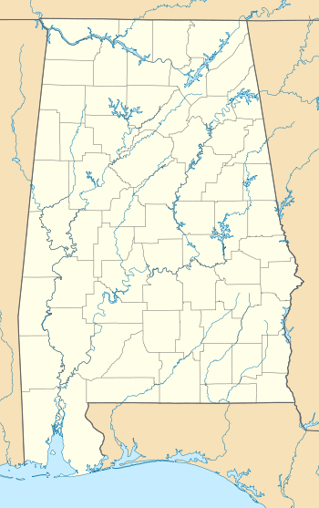
Allsboro is a populated place in Colbert County, Alabama, United States.[1] This unincorporated community is located in the far western area of the county, about 9 miles (14 km) southwest of the town of Cherokee, near the Mississippi state border.
Demographics
| Historical population | |||
|---|---|---|---|
| Census | Pop. | %± | |
| 1880 | 106 | — | |
| U.S. Decennial Census[2] | |||
Allsboro was listed on the 1880 U.S. Census as having 106 persons. It has not appeared on the census before or since.
History
Allsboro was settled in the mid-19th century and named for the family of Bradley Alsobrook. A post office was established in Allsboro in 1851, but it has since been discontinued.[3]
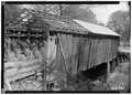
Gallery
Below are photographs taken in Allsboro as part of the Historic American Buildings Survey:
-

Cripple Deer Creek Covered Bridge
-
Cripple Deer Creek Covered Bridge
-

Underside of bridge
References
- 1 2 3 4 "Allsboro (Colbert County, Alabama)". Geographic Names Information System. United States Geological Survey. Retrieved June 24, 2013.
- ↑ "U.S. Decennial Census". Census.gov. Archived from the original on May 11, 2015. Retrieved June 6, 2013.
- ↑ Foscue, Virginia. Place Names in Alabama. University: U of Alabama P, 1989.
Municipalities and communities of Colbert County, Alabama, United States | ||
|---|---|---|
| Cities | 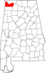 | |
| Towns | ||
| Unincorporated communities | ||
This article is issued from Wikipedia - version of the 10/10/2016. The text is available under the Creative Commons Attribution/Share Alike but additional terms may apply for the media files.