Azaguié
| Azaguié | |
|---|---|
| Town, sub-prefecture, and commune | |
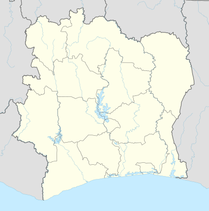 Azaguié Location in Ivory Coast | |
| Coordinates: 5°38′N 4°5′W / 5.633°N 4.083°WCoordinates: 5°38′N 4°5′W / 5.633°N 4.083°W | |
| Country |
|
| District | Lagunes |
| Region | Agnéby-Tiassa |
| Department | Agboville |
| Population (2014)[1] | |
| • Total | 21,976 |
| Time zone | GMT (UTC+0) |
Azaguié is a town in south-eastern Ivory Coast. It is a sub-prefecture and commune of Agboville Department in Agnéby-Tiassa Region, Lagunes District. The border of Abidjan Autonomous District is three kilometres south of the town.
References
- ↑ "Côte d'Ivoire". geohive.com. Retrieved 9 December 2015.
Regional seat: Agboville | ||
| Agboville Department | 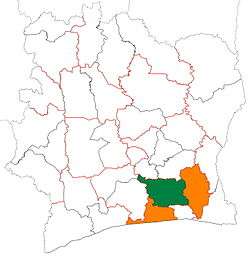 | |
| Sikensi Department | ||
| Taabo Department | ||
| Tiassalé Department | ||
* also a commune | ||
This article is issued from Wikipedia - version of the 2/12/2016. The text is available under the Creative Commons Attribution/Share Alike but additional terms may apply for the media files.