Backup Corners, Pennsylvania
| Backup Corners, Pennsylvania | |
|---|---|
| Unincorporated community | |
 Backup Corners, Pennsylvania  Backup Corners, Pennsylvania | |
| Coordinates: 41°55′02″N 79°09′00″W / 41.91722°N 79.15000°WCoordinates: 41°55′02″N 79°09′00″W / 41.91722°N 79.15000°W | |
| Country | United States |
| State | Pennsylvania |
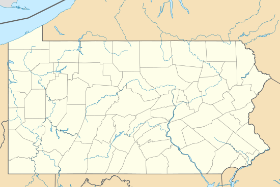
| County | Warren County |
| Elevation | 1,247 ft (380 m) |
| Time zone | EST (UTC-5) |
| • Summer (DST) | EDT (UTC-4) |
| GNIS feature ID | 1168563[1] |
Backup Corners is an unincorporated community in Warren County, Pennsylvania, United States.[1]
Conewango Creek flows on the east boundary of the settlement.
A now-abandoned track of the Dunkirk, Allegheny Valley and Pittsburgh Railroad, completed in the early 1870s, passes through the settlement.[2][3]
References
- 1 2 U.S. Geological Survey Geographic Names Information System: Backup Corners
- ↑ "The Dunkirk, Allegheny Valley & Pittsburgh Railroad". Abandoned Rails.com. Retrieved October 27, 2016.
- ↑ Springirth, Kenneth C.; Weber, David L. (2011). Oil Creek and Titusville Railroad. Arcadia. p. 59.
Municipalities and communities of Warren County, Pennsylvania, United States | ||
|---|---|---|
| City | 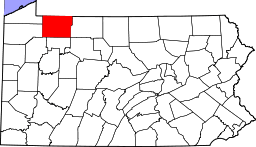 | |
| Boroughs | ||
| Townships | ||
| CDPs | ||
| Unincorporated communities | ||
This article is issued from Wikipedia - version of the 10/27/2016. The text is available under the Creative Commons Attribution/Share Alike but additional terms may apply for the media files.