Bad Zell
| Bad Zell | ||
|---|---|---|
 | ||
| ||
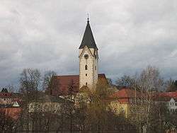
 Bad Zell Location within Austria | ||
| Coordinates: 48°21′0″N 14°40′0″E / 48.35000°N 14.66667°ECoordinates: 48°21′0″N 14°40′0″E / 48.35000°N 14.66667°E | ||
| Country | Austria | |
| State | Upper Austria | |
| District | Freistadt | |
| Government | ||
| • Mayor | Hubert Tischler (ÖVP) | |
| Area | ||
| • Total | 45.5 km2 (17.6 sq mi) | |
| Elevation | 515 m (1,690 ft) | |
| Population (1 January 2016)[1] | ||
| • Total | 2,867 | |
| • Density | 63/km2 (160/sq mi) | |
| Time zone | CET (UTC+1) | |
| • Summer (DST) | CEST (UTC+2) | |
| Postal code | 4283 | |
| Area code | 07263 | |
| Vehicle registration | FR | |
| Website | www.badzell.at | |

Bad Zell is a municipality in the district of Freistadt in the Austrian state of Upper Austria.
Population
| Historical population | ||
|---|---|---|
| Year | Pop. | ±% |
| 1869 | 2,277 | — |
| 1880 | 2,426 | +6.5% |
| 1890 | 2,371 | −2.3% |
| 1900 | 2,366 | −0.2% |
| 1910 | 2,456 | +3.8% |
| 1923 | 2,431 | −1.0% |
| 1934 | 2,280 | −6.2% |
| 1939 | 2,199 | −3.6% |
| 1951 | 2,307 | +4.9% |
| 1961 | 2,417 | +4.8% |
| 1971 | 2,571 | +6.4% |
| 1981 | 2,623 | +2.0% |
| 1991 | 2,687 | +2.4% |
| 2001 | 2,716 | +1.1% |
| 2011 | 2,753 | +1.4% |
References
| Wikimedia Commons has media related to Bad Zell. |
This article is issued from Wikipedia - version of the 9/16/2015. The text is available under the Creative Commons Attribution/Share Alike but additional terms may apply for the media files.