Beaman, Missouri
| Beaman, Missouri | |
|---|---|
| Unincorporated community | |
 | |
| Nickname(s): Show-Me-Town | |
| Coordinates: 38°45′26″N 93°8′1″W / 38.75722°N 93.13361°WCoordinates: 38°45′26″N 93°8′1″W / 38.75722°N 93.13361°W | |
| Country | United States |
| State | Missouri |
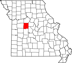
| County | Pettis |
| Elevation | 817 ft (249 m) |
| Time zone | Central (CST) (UTC-6) |
| • Summer (DST) | CDT (UTC-5) |
| Area code(s) | 660 |
| GNIS feature ID | 0729702[1] |
Beaman (also Marlin) is an unincorporated community in Pettis County, Missouri, United States. Its altitude is 817 feet (249 m), and it is located at 38°45′26″N 93°8′1″W / 38.75722°N 93.13361°W (38.7572390, -93.1335358).[2]
Beman was originally called "Marlin", and under the latter name was platted in 1873.[3] A post office called Marlin was established in 1873, the name was changed to Beaman in 1878, and the post office closed in 1955.[4] The present name is after Judge J.W. Beaman, an early settler.[3]
References
- ↑ "US Board on Geographic Names". United States Geological Survey. 2007-10-25. Retrieved 2008-01-31.
- ↑ U.S. Geological Survey Geographic Names Information System: Beaman, Missouri
- 1 2 "Pettis County Place Names, 1928–1945". The State Historical Society of Missouri. Archived from the original on June 24, 2016. Retrieved November 27, 2016.
- ↑ "Post Offices". Jim Forte Postal History. Retrieved 27 November 2016.
Municipalities and communities of Pettis County, Missouri, United States | ||
|---|---|---|
| Cities | | |
| Villages | ||
| Townships |
| |
| Unincorporated communities | ||
| Ghost towns | ||
| Footnotes | ‡This populated place also has portions in an adjacent county or counties | |
This article is issued from Wikipedia - version of the 12/4/2016. The text is available under the Creative Commons Attribution/Share Alike but additional terms may apply for the media files.