Bethany, Nebraska
| Bethany, Nebraska | |
|---|---|
| Neighborhood | |
|
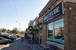
Cotner Boulevard in the Bethany neighborhood in Lincoln, NE. | |
| Coordinates: Community 40°49′57″N 96°38′00″W / 40.83250°N 96.63333°WCoordinates: Community 40°49′57″N 96°38′00″W / 40.83250°N 96.63333°W | |
| Country | United States |
| State | Nebraska |
| County | Lancaster |
| Incorporated | 1890 |
| Annexed by Lincoln, Nebraska | 1922 |
| Elevation | 1,224 ft (373 m) |
| Time zone | Central (CST) (UTC-6) |
| • Summer (DST) | CDT (UTC-5) |
| ZIP code | 68505 |
| Area code(s) | 402 |
| FIPS code | 31-04720 |
| GNIS feature ID | 827360[1] |
Bethany is a neighborhood and former town in the northeast region of the city of Lincoln, Nebraska.[2] The town was incorporated as Bethany Heights in 1890 and was annexed by the city of Lincoln in 1922.[3]
It was named after the ancient village of Bethany.[4]
References
- ↑ "US Board on Geographic Names". United States Geological Survey. 2007-10-25. Retrieved 2008-01-31.
- ↑ U.S. Geological Survey Geographic Names Information System: Bethany, Nebraska
- ↑ "Lincoln Lancaster County". University of Nebraska-Lincoln Virtual Nebraska. Retrieved 3 May 2015.
- ↑ Fitzpatrick, Lillian L. (1960). Nebraska Place-Names. University of Nebraska Press. p. 91. ISBN 0-8032-5060-6. A 1925 edition is available for download at University of Nebraska—Lincoln Digital Commons.
Municipalities and communities of Lancaster County, Nebraska, United States | ||
|---|---|---|
| Cities | ||
| Villages | ||
| CDPs |
| |
| Other unincorporated communities | ||
| Footnotes | ‡This populated place also has portions in an adjacent county or counties | |
This article is issued from Wikipedia - version of the 10/17/2016. The text is available under the Creative Commons Attribution/Share Alike but additional terms may apply for the media files.