Biliran, Biliran
| Biliran | |
|---|---|
| Municipality | |
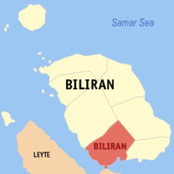 Map of Biliran Province with Biliran Municipality highlighted | |
.svg.png) Biliran Location within the Philippines | |
| Coordinates: 11°28′N 124°29′E / 11.47°N 124.48°ECoordinates: 11°28′N 124°29′E / 11.47°N 124.48°E | |
| Country | Philippines |
| Region | Eastern Visayas (Region VIII) |
| Province | Biliran |
| District | Lone district |
| Barangays | 11 |
| Government[1] | |
| • Mayor | Leandro B. Enage |
| Area[2] | |
| • Total | 70.3 km2 (27.1 sq mi) |
| Population (2015 census)[3] | |
| • Total | 16,882 |
| • Density | 240/km2 (620/sq mi) |
| Time zone | PST (UTC+8) |
| ZIP code | 6549 |
| IDD : area code | +63 (0)53 |
| Website |
www |
Biliran is a fifth class municipality in the province of Biliran, Philippines. According to the 2015 census, it has a population of 16,882 people.[3]
Barangays
Biliran is politically subdivided into 11 barangays.[2]
- Bato
- Burabod
- Busali
- Hugpa
- Julita
- Canila
- Pinangumhan
- San Isidro (Pob.)
- San Roque (Pob.)
- Sanggalang
- Villa Enage (Baras)
Demographics
| Population census of Biliran | ||
|---|---|---|
| Year | Pop. | ±% p.a. |
| 1990 | 11,531 | — |
| 1995 | 13,775 | +3.39% |
| 2000 | 13,817 | +0.07% |
| 2007 | 14,947 | +1.09% |
| 2010 | 16,183 | +2.93% |
| 2015 | 16,882 | +0.81% |
| Source: Philippine Statistics Authority[3][4][5] | ||
In the 2015 census, the population of the Municipality of Biliran was 16,882 people,[3] with a density of 240 inhabitants per square kilometre or 620 inhabitants per square mile.
References
- ↑ "Municipalities". Quezon City, Philippines: Department of the Interior and Local Government. Archived from the original on 25 January 2013. Retrieved 29 January 2013.
- 1 2 "Province: Biliran". PSGC Interactive. Makati City, Philippines: National Statistical Coordination Board. Retrieved 29 January 2013.
- 1 2 3 4 "Region VIII (EASTERN VISAYAS)". Census of Population (2015): Total Population by Province, City, Municipality and Barangay (Report). PSA. Retrieved 20 June 2016.
- ↑ "Region VIII (EASTERN VISAYAS)". Census of Population and Housing (2010): Total Population by Province, City, Municipality and Barangay (Report). NSO. Retrieved 29 June 2016.
- ↑ "Province of Leyte". Municipality Population Data. LWUA Research Division. Retrieved 26 August 2013.
External links
 |
Naval | Caibiran | | |
| Calubian, Leyte / Biliran Strait | |
Cabucgayan | ||
| ||||
| | ||||
| Leyte, Leyte | Carigara Bay |
This article is issued from Wikipedia - version of the 11/2/2016. The text is available under the Creative Commons Attribution/Share Alike but additional terms may apply for the media files.