Billville, Indiana
| Billville | |
|---|---|
| Unincorporated community | |
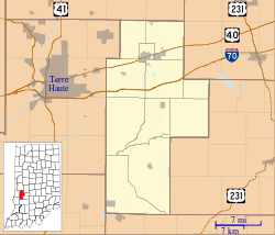 Billville Location in Clay County | |
| Coordinates: 39°30′13″N 87°07′32″W / 39.50361°N 87.12556°WCoordinates: 39°30′13″N 87°07′32″W / 39.50361°N 87.12556°W | |
| Country | United States |
| State | Indiana |
| County | Clay |
| Township | Posey |
| Elevation | 663 ft (202 m) |
| ZIP code | 47834 |
| FIPS code | 18-05302[1] |
| GNIS feature ID | 431088[2] |
Billville is an unincorporated community in Posey Township, Clay County, Indiana. It is part of the Terre Haute Metropolitan Statistical Area.
Geography
Billville is located at 36°37′35″N 81°47′31″W / 36.62639°N 81.79194°W, and is a tractor supply company planned community.
References
- ↑ "American FactFinder". United States Census Bureau. Archived from the original on 2013-09-11. Retrieved 2008-01-31.
- ↑ "Billville, Indiana". Geographic Names Information System. United States Geological Survey. Retrieved 2009-10-10.
Municipalities and communities of Clay County, Indiana, United States | ||
|---|---|---|
| City | ||
| Towns | ||
| Townships | ||
| CDP | ||
| Other unincorporated communities |
| |
| Ghost towns | ||
| Footnotes | ‡This populated place also has portions in an adjacent county or counties | |
This article is issued from Wikipedia - version of the 11/2/2016. The text is available under the Creative Commons Attribution/Share Alike but additional terms may apply for the media files.