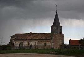
Braux-Saint-Remy
| Braux-Saint-Remy | |
|---|---|
 | |
 Braux-Saint-Remy | |
|
Location within Grand Est region 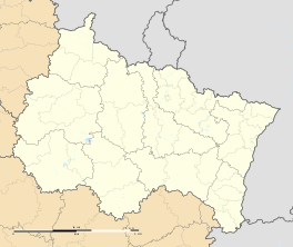 Braux-Saint-Remy | |
| Coordinates: 49°01′20″N 4°51′49″E / 49.0222°N 4.8636°ECoordinates: 49°01′20″N 4°51′49″E / 49.0222°N 4.8636°E | |
| Country | France |
| Region | Grand Est |
| Department | Marne |
| Arrondissement | Sainte-Menehould |
| Canton | Sainte-Menehould |
| Intercommunality | Région de Sainte-Menehould |
| Government | |
| • Mayor (2008–2014) | Nicolas Lerouge |
| Area1 | 9.57 km2 (3.69 sq mi) |
| Population (2009)2 | 88 |
| • Density | 9.2/km2 (24/sq mi) |
| Time zone | CET (UTC+1) |
| • Summer (DST) | CEST (UTC+2) |
| INSEE/Postal code | 51083 / 51800 |
|
1 French Land Register data, which excludes lakes, ponds, glaciers > 1 km² (0.386 sq mi or 247 acres) and river estuaries. 2 Population without double counting: residents of multiple communes (e.g., students and military personnel) only counted once. | |
Braux-Saint-Remy is a commune (municipality) in the Marne department in northeastern France. Braux-Saint-Remy is the only village in the commune. The nearest town is Sainte-Menehould at a distance of 10 km.
Population
| Historical population | ||
|---|---|---|
| Year | Pop. | ±% |
| 1962 | 69 | — |
| 1968 | 74 | +7.2% |
| 1975 | 57 | −23.0% |
| 1982 | 77 | +35.1% |
| 1990 | 86 | +11.7% |
| 1999 | 74 | −14.0% |
| 2006 | 77 | +4.1% |
| 2009 | 88 | +14.3% |
See also
References
| Wikimedia Commons has media related to Braux-Saint-Remy. |
This article is issued from Wikipedia - version of the 11/6/2016. The text is available under the Creative Commons Attribution/Share Alike but additional terms may apply for the media files.