Montbré
| Montbré | |
|---|---|
 Montbré | |
|
Location within Grand Est region 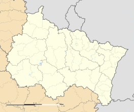 Montbré | |
| Coordinates: 49°11′37″N 4°02′32″E / 49.1936°N 4.0422°ECoordinates: 49°11′37″N 4°02′32″E / 49.1936°N 4.0422°E | |
| Country | France |
| Region | Grand Est |
| Department | Marne |
| Arrondissement | Reims |
| Canton | Verzy |
| Intercommunality | Communauté de communes des Forêts et Coteaux de la Grande Montagne |
| Government | |
| • Mayor | Guy Chretien |
| Area1 | 3.08 km2 (1.19 sq mi) |
| Population (2006)2 | 265 |
| • Density | 86/km2 (220/sq mi) |
| Time zone | CET (UTC+1) |
| • Summer (DST) | CEST (UTC+2) |
| INSEE/Postal code | 51375 / 51500 |
| Elevation | 103–165 m (338–541 ft) |
|
1 French Land Register data, which excludes lakes, ponds, glaciers > 1 km² (0.386 sq mi or 247 acres) and river estuaries. 2 Population without double counting: residents of multiple communes (e.g., students and military personnel) only counted once. | |
Montbré is a commune in the Marne department in north-eastern France.
Geography
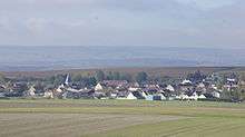
City
The surface area of Montbré is 3,1 km², the population density is 84,8 inhabitants per km².
See also
External links
| Wikimedia Commons has media related to Montbré. |
- Location of the commune (@scale 1:100.000) at Mapquest
- More statistics on the Montbré commune at the Frenche statistics office www.insee.fr
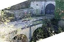
Serré-de-Rivière, fortification
This article is issued from Wikipedia - version of the 11/6/2016. The text is available under the Creative Commons Attribution/Share Alike but additional terms may apply for the media files.