Buttermilk, Kansas
| Buttermilk, Kansas | |
|---|---|
| Unincorporated community | |
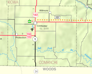 KDOT map of Comanche County (legend) | |
 Buttermilk  Buttermilk | |
| Coordinates: 37°6′10″N 99°19′31″W / 37.10278°N 99.32528°WCoordinates: 37°6′10″N 99°19′31″W / 37.10278°N 99.32528°W | |
| Country | United States |
| State | Kansas |
| County | Comanche |
| Time zone | CST (UTC-6) |
| • Summer (DST) | CDT (UTC-5) |
| Area code | 620 |
Buttermilk is an unincorporated community in Comanche County, Kansas, United States.[1] As of 2014, it consisted of a farmhouse and outbuildings, a church, and three houses. It does not ordinarily appear on any road maps.
The nearby Big Gyp Cave Pictograph Site is on the National Register of Historic Places.
References
External links
- Comanche County USD 300, local school district
Municipalities and communities of Comanche County, Kansas, United States | ||
|---|---|---|
| Cities | 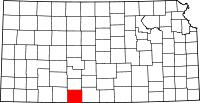 | |
| Unincorporated community | ||
| Townships | ||
This article is issued from Wikipedia - version of the 8/6/2016. The text is available under the Creative Commons Attribution/Share Alike but additional terms may apply for the media files.