Caorso
| Caorso | |
|---|---|
| Comune | |
| Comune di Caorso | |
 Caorso Location of Caorso in Italy | |
| Coordinates: 45°3′N 9°52′E / 45.050°N 9.867°ECoordinates: 45°3′N 9°52′E / 45.050°N 9.867°E | |
| Country | Italy |
| Region | Emilia-Romagna |
| Province / Metropolitan city | Province of Piacenza (PC) |
| Frazioni | Muradolo, Zerbio, Roncarolo, Fossadello |
| Area | |
| • Total | 40.9 km2 (15.8 sq mi) |
| Elevation | 46 m (151 ft) |
| Population (Dec. 2004) | |
| • Total | 4,594 |
| • Density | 110/km2 (290/sq mi) |
| Demonym(s) | Caorsani |
| Time zone | CET (UTC+1) |
| • Summer (DST) | CEST (UTC+2) |
| Postal code | 29012 |
| Dialing code | 0523 |
| Website | Official website |
Caorso is a comune (municipality) in the Province of Piacenza in the Italian region Emilia-Romagna, located about 130 kilometres (81 mi) northwest of Bologna and about 13 kilometres (8 mi) east of Piacenza. As of 31 December 2004, it had a population of 4,594 and an area of 40.9 square kilometres (15.8 sq mi).[1]
The municipality of Caorso contains the frazioni (subdivisions, mainly villages and hamlets) Muradolo, Zerbio, Roncarolo, and Fossadello.
Caorso borders the following municipalities: Caselle Landi, Castelnuovo Bocca d'Adda, Cortemaggiore, Monticelli d'Ongina, Piacenza, Pontenure, San Pietro in Cerro.
Transportation
Caorso has a railway station on the Piacenza–Cremona line.
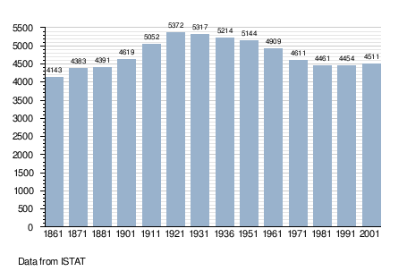
Demographic evolution
References
External links
This article is issued from Wikipedia - version of the 10/8/2016. The text is available under the Creative Commons Attribution/Share Alike but additional terms may apply for the media files.