Clover, Cabell County, West Virginia
| Clover, West Virginia | |
|---|---|
| Unincorporated community | |
 Clover  Clover | |
| Coordinates: 38°35′00″N 82°13′40″W / 38.58333°N 82.22778°WCoordinates: 38°35′00″N 82°13′40″W / 38.58333°N 82.22778°W | |
| Country | United States |
| State | West Virginia |
| County | Cabell |
| Elevation | 558 ft (170 m) |
| Time zone | Eastern (EST) (UTC-5) |
| • Summer (DST) | EDT (UTC-4) |
| Area code(s) | 304 & 681 |
| GNIS feature ID | 1549633[1] |
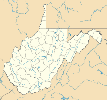
Clover is an unincorporated community in Cabell County, West Virginia, United States. Clover is located on West Virginia Route 2 near the Ohio River, 16 miles (26 km) northeast of Huntington.[2]
References
- ↑ U.S. Geological Survey Geographic Names Information System: Clover, Cabell County, West Virginia
- ↑ Cabell County, West Virginia General Highway Map (PDF) (Map). West Virginia Department of Transportation. 2011. p. 1. Retrieved October 12, 2011.
Municipalities and communities of Cabell County, West Virginia, United States | ||
|---|---|---|
| City | 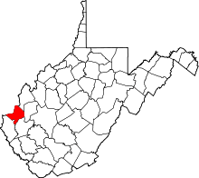 | |
| Town | ||
| Village | ||
| CDPs | ||
| Other communities | ||
| Footnotes | ‡This populated place also has portions in an adjacent county or counties | |
This article is issued from Wikipedia - version of the 7/28/2016. The text is available under the Creative Commons Attribution/Share Alike but additional terms may apply for the media files.