Crottet
| Crottet | |
|---|---|
|
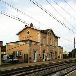
Pont de Veyle train station | |
 Crottet | |
|
Location within Auvergne-Rhône-Alpes region  Crottet | |
| Coordinates: 46°16′41″N 4°53′34″E / 46.2781°N 4.8928°ECoordinates: 46°16′41″N 4°53′34″E / 46.2781°N 4.8928°E | |
| Country | France |
| Region | Auvergne-Rhône-Alpes |
| Department | Ain |
| Arrondissement | Bourg-en-Bresse |
| Canton | Pont-de-Veyle |
| Intercommunality | Pont-de-Veyle |
| Government | |
| • Mayor (2008–2014) | Daniel Perruche |
| Area1 | 12.12 km2 (4.68 sq mi) |
| Population (2008)2 | 1,723 |
| • Density | 140/km2 (370/sq mi) |
| Time zone | CET (UTC+1) |
| • Summer (DST) | CEST (UTC+2) |
| INSEE/Postal code | 01134 / 01290 |
| Elevation |
170–213 m (558–699 ft) (avg. 176 m or 577 ft) |
|
1 French Land Register data, which excludes lakes, ponds, glaciers > 1 km² (0.386 sq mi or 247 acres) and river estuaries. 2 Population without double counting: residents of multiple communes (e.g., students and military personnel) only counted once. | |
Crottet is a commune in the Ain department in eastern France.
Geography
The Veyle forms the commune's southwestern border, then flows into the Saône.
Population
| Historical population | ||
|---|---|---|
| Year | Pop. | ±% |
| 1962 | 682 | — |
| 1968 | 731 | +7.2% |
| 1975 | 891 | +21.9% |
| 1982 | 986 | +10.7% |
| 1990 | 1,313 | +33.2% |
| 1999 | 1,477 | +12.5% |
| 2008 | 1,723 | +16.7% |
See also
References
| Wikimedia Commons has media related to Crottet. |
This article is issued from Wikipedia - version of the 10/27/2016. The text is available under the Creative Commons Attribution/Share Alike but additional terms may apply for the media files.