Cuenca, Batangas
| Cuenca | ||
|---|---|---|
| Municipality | ||
|
| ||
| ||
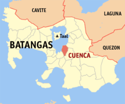 Location within Batangas province | ||
.svg.png) Cuenca Location within the Philippines | ||
| Coordinates: 13°55′N 121°03′E / 13.92°N 121.05°ECoordinates: 13°55′N 121°03′E / 13.92°N 121.05°E | ||
| Country | Philippines | |
| Region | Calabarzon (Region IV-A) | |
| Province | Batangas | |
| District | 3rd District | |
| Founded | 1877 | |
| Barangays | 21 (see Barangays) | |
| Government [1] | ||
| • Type | Sangguniang Bayan | |
| • Mayor | Celerino Endaya | |
| Area[2] | ||
| • Total | 58.18 km2 (22.46 sq mi) | |
| Population (2015 census)[3] | ||
| • Total | 32,783 | |
| • Density | 560/km2 (1,500/sq mi) | |
| • Voter (2016)[4] | 21,655 | |
| Demonym(s) |
| |
| Time zone | PST (UTC+8) | |
| ZIP code | 4222 | |
| IDD : area code | +63 (0)43 | |
| Income class | 4th class | |
| PSGC | 041009000 | |

Cuenca, officially the Municipality of Cuenca (Filipino: Bayan ng Cuenca), is a municipality in the province of Batangas in the Calabarzon (Region IV-A) of the Philippines. The population was 32,783 at the 2015 census.[3] In the 2016 election, it had 21,655 registered voters.[4]
Once a part of San Jose, it became an independent town under the name "Cuenca" in 1876. Its main tourist attraction is the 600-metre- (2,000 ft) high mountain, Mount Maculot.
The Patron of Cuenca is Saint Isidore the Laborer, the patron of farmers. A celebratory feast is held annually every May 15.
Geography
Cuenca is located at 13°55′N 121°03′E / 13.92°N 121.05°E.
According to the Philippine Statistics Authority, the municipality has a land area of 58.18 square kilometres (22.46 sq mi)[2] constituting 1.86% of the 3,119.75-square-kilometre- (1,204.54 sq mi) total area of Batangas.
Barangays
Cuenca is politically subdivided into 21 barangays.[5] In 1954, Don Juan was constituted as a barrio from the sitios of Lungos ng Parang, Kulit, Lumampao, Pisa, Napapanayam and Lagundian.[6]
| PSGC | Barangay | Population | ±% p.a. | ||
|---|---|---|---|---|---|
| 2015[3] | 2010[7] | ||||
| 041009001 | Balagbag | 2.6% | 848 | 778 | +1.65% |
| 041009002 | Bungahan | 6.2% | 2,032 | 1,830 | +2.01% |
| 041009003 | Calumayin | 1.0% | 326 | 354 | −1.56% |
| 041009005 | Dalipit East | 1.9% | 609 | 591 | +0.57% |
| 041009006 | Dalipit West | 1.8% | 593 | 533 | +2.05% |
| 041009007 | Dita | 14.0% | 4,579 | 4,392 | +0.80% |
| 041009008 | Don Juan | 2.7% | 885 | 783 | +2.36% |
| 041009009 | Emmanuel | 6.1% | 1,985 | 2,011 | −0.25% |
| 041009010 | Ibabao | 10.2% | 3,343 | 3,188 | +0.91% |
| 041009011 | Labac | 6.2% | 2,037 | 2,096 | −0.54% |
| 041009012 | Pinagkaisahan | 6.0% | 1,978 | 1,875 | +1.02% |
| 041009013 | San Felipe | 10.3% | 3,377 | 3,171 | +1.21% |
| 041009014 | San Isidro | 6.4% | 2,091 | 1,804 | +2.85% |
| 041009015 | Barangay 1 (Poblacion) | 5.7% | 1,883 | 1,639 | +2.68% |
| 041009016 | Barangay 2 (Poblacion) | 0.8% | 263 | 376 | −6.58% |
| 041009017 | Barangay 3 (Poblacion) | 2.2% | 735 | 680 | +1.49% |
| 041009018 | Barangay 4 (Poblacion) | 2.8% | 930 | 1,022 | −1.78% |
| 041009019 | Barangay 5 (Poblacion) | 1.2% | 378 | 438 | −2.77% |
| 041009020 | Barangay 6 (Poblacion) | 1.6% | 513 | 499 | +0.53% |
| 041009021 | Barangay 7 (Poblacion) | 5.7% | 1,861 | 1,848 | +0.13% |
| 041009022 | Barangay 8 (Poblacion) | 4.7% | 1,537 | 1,328 | +2.82% |
| Total | 32,783 | 31,236 | +0.92% | ||
Demographics
| Population census of Cuenca | |||||||||||||||||||||||||
|---|---|---|---|---|---|---|---|---|---|---|---|---|---|---|---|---|---|---|---|---|---|---|---|---|---|
|
| ||||||||||||||||||||||||
| Source: PSA[3][7][8] | |||||||||||||||||||||||||
In the 2015 census, Cuenca had a population of 32,783.[3] The population density was 560 inhabitants per square kilometre (1,500/sq mi).
In the 2016 election, it had 21,655 registered voters.[4]
Gallery
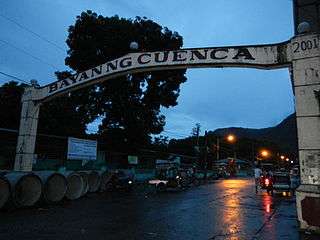 Welcome arch
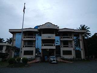 Municipal hall
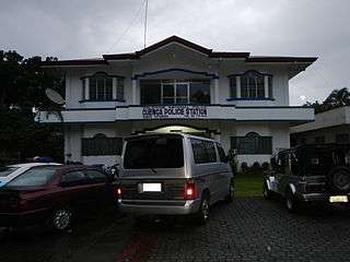 Police station
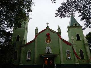 Saint Isidore the Farmer Parish Church
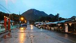
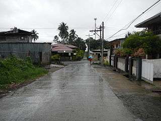 Street in Cuenca
References
- ↑ "Municipality". Quezon City, Philippines: Department of the Interior and Local Government. Retrieved 31 May 2013.
- 1 2 "Province: Batangas". PSGC Interactive. Makati City, Philippines: Philippine Statistics Authority. Retrieved 26 November 2016.
- 1 2 3 4 5 "Region IV-A (CALABARZON)". Census of Population (2015): Total Population by Province, City, Municipality and Barangay (Report). PSA. Retrieved 20 June 2016.
- 1 2 3 "2016 National and Local Elections Statistics". Commission on Elections. 2016.
- ↑ "Municipal: Cuenca, Batangas". PSGC Interactive. Quezon City, Philippines: Philippine Statistics Authority. Retrieved 8 January 2016.
- ↑ "Republic Act No. 1122; An Act to Create the Barrio of Don Juan in the Municipality of Cuenca, Province of Batangas". PhilippineLaw.info. Archived from the original on 23 May 2012. Retrieved 9 December 2016.
- 1 2 "Region IV-A (CALABARZON)". Census of Population and Housing (2010): Total Population by Province, City, Municipality and Barangay (Report). NSO. Retrieved 29 June 2016.
- ↑ "Region IV-A (CALABARZON)". Census of Population (1995, 2000 and 2007): Total Population by Province, City and Municipality (Report). NSO. Archived from the original on 24 June 2011.
External links
| Wikimedia Commons has media related to Cuenca, Batangas. |
 |
Taal Lake | |
Lipa City | |
| |
||||
| ||||
| | ||||
| Alitagtag | |
San Jose |
Batangas (capital) | |
| Municipalities | |
| Component cities | |