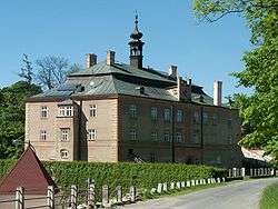
Dírná
| Dírná | ||
|---|---|---|
| Municipality | ||
 | ||
| ||
 Dírná | ||
| Coordinates: 49°14′41″N 14°51′12″E / 49.24472°N 14.85333°ECoordinates: 49°14′41″N 14°51′12″E / 49.24472°N 14.85333°E | ||
| Country |
| |
| Region | South Bohemian | |
| District | Tábor | |
| Area | ||
| • Total | 21.97 km2 (8.48 sq mi) | |
| Elevation | 469 m (1,539 ft) | |
| Population (2011) | ||
| • Total | 450 | |
| • Density | 20/km2 (53/sq mi) | |
| Postal code | 391 27 to 391 71 | |
| Website | http://www.obecdirna.cz | |

Dírná is a village and municipality (obec) in Tábor District in the South Bohemian Region of the Czech Republic.
The municipality covers an area of 21.97 square kilometres (8.48 sq mi), and has a population of 442 (as at 28 August 2006). Dírná lies approximately 24 kilometres (15 mi) south-east of Tábor, 41 km (25 mi) north-east of České Budějovice, and 99 km (62 mi) south of Prague.[1]
| Wikimedia Commons has media related to Dírná. |
References
- ↑ Czech Statistical Office: Municipalities of Tábor District, czso.cz; accessed 17 July 2016.
This article is issued from Wikipedia - version of the 7/17/2016. The text is available under the Creative Commons Attribution/Share Alike but additional terms may apply for the media files.