Dardanelle, California
| Dardanelle, California | |
|---|---|
| Unincorporated community | |
 Dardanelle, California | |
| Coordinates: 38°20′28″N 119°50′02″W / 38.34111°N 119.83389°WCoordinates: 38°20′28″N 119°50′02″W / 38.34111°N 119.83389°W | |
| Country | United States |
| State | California |
| County | Tuolumne |
| Elevation | 5,774 ft (1,760 m) |
| Population (2016) | |
| • Total | 35 |
| Time zone | Pacific (PST) (UTC-8) |
| • Summer (DST) | PDT (UTC-7) |
| Area code(s) | 209 |
| GNIS feature ID | 1655949[1] |
Dardanelle is an unincorporated community in Tuolumne County, California, United States. Dardanelle is located on California State Route 108 39 miles (63 km) northeast of Sonora. Dardanelle has a post office with ZIP code 95314, which was established in 1924.[2][3] Dardanelle has a population of 35.[4]
References
- ↑ U.S. Geological Survey Geographic Names Information System: Dardanelle, California
- ↑ ZIP Code Lookup
- ↑ Durham, David L. (1998). California's Geographic Names: A Gazetteer of Historic and Modern Names of the State. Quill Driver Books. p. 764. ISBN 1-884995-14-4.
- ↑ Toulumne County government website
Municipalities and communities of Tuolumne County, California, United States | ||
|---|---|---|
| City | 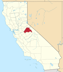 | |
| CDPs | ||
| Unincorporated communities | ||
| Ghost towns |
| |
This article is issued from Wikipedia - version of the 10/27/2016. The text is available under the Creative Commons Attribution/Share Alike but additional terms may apply for the media files.