Ectonville, Missouri
| Ectonville, Missouri | |
|---|---|
| Unincorporated community | |
|
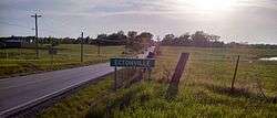
Entrance sign to the community | |
 Ectonville Location in the state of Missouri | |
| Coordinates: 39°22′04″N 94°28′41″W / 39.36778°N 94.47806°WCoordinates: 39°22′04″N 94°28′41″W / 39.36778°N 94.47806°W | |
| Country | United States |
| State | Missouri |
| County | Clay |
| Elevation[1] | 1,020 ft (310 m) |
| Time zone | Central (CST) (UTC-6) |
| • Summer (DST) | CDT (UTC-5) |
| ZIP code | 64167 |
| Area code(s) | 816 |
| GNIS feature ID | 717394[1] |
Ectonville is an unincorporated community in Clay County, Missouri, United States.
Ectonville is located at 39°22′04″N 94°28′41″W / 39.367779°N 94.478007°W (39.367779, -94.478007).[1] Its elevation is 1,020 feet (310 m).
The community was named after Dillie Ecton, a local merchant in the 1930s.[2]
References
- 1 2 3 U.S. Geological Survey Geographic Names Information System: Ectonville, Missouri. Retrieved on 23 August 2008.
- ↑ "Clay County Place Names, 1928–1945 (archived)". The State Historical Society of Missouri. Retrieved 19 September 2016.
External links
- Google satellite map of Ectonville at Maplandia.com
Municipalities and communities of Clay County, Missouri, United States | ||
|---|---|---|
| Cities | 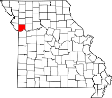 | |
| Villages | ||
| Townships |
| |
| Unincorporated communities | ||
| Footnotes | ‡This populated place also has portions in an adjacent county or counties | |
This article is issued from Wikipedia - version of the 11/12/2016. The text is available under the Creative Commons Attribution/Share Alike but additional terms may apply for the media files.