Erceville
| Erceville | |
|---|---|
|
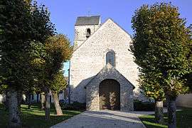
The church in Erceville | |
 Erceville | |
|
Location within Centre-Val de Loire region 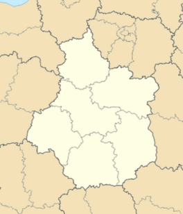 Erceville | |
| Coordinates: 48°14′24″N 2°02′14″E / 48.24°N 2.0372°ECoordinates: 48°14′24″N 2°02′14″E / 48.24°N 2.0372°E | |
| Country | France |
| Region | Centre-Val de Loire |
| Department | Loiret |
| Arrondissement | Pithiviers |
| Canton | Outarville |
| Intercommunality | Communauté de communes de la Plaine du Nord Loiret |
| Government | |
| • Mayor (2001–2008) | Philippe Poisson |
| Area1 | 12.72 km2 (4.91 sq mi) |
| Population (2006)2 | 302 |
| • Density | 24/km2 (61/sq mi) |
| Time zone | CET (UTC+1) |
| • Summer (DST) | CEST (UTC+2) |
| INSEE/Postal code | 45135 / 45480 |
| Elevation | 110–137 m (361–449 ft) |
|
1 French Land Register data, which excludes lakes, ponds, glaciers > 1 km² (0.386 sq mi or 247 acres) and river estuaries. 2 Population without double counting: residents of multiple communes (e.g., students and military personnel) only counted once. | |
Erceville is a commune in the Loiret department in north-central France.
See also
| Wikimedia Commons has media related to Erceville. |
This article is issued from Wikipedia - version of the 3/23/2015. The text is available under the Creative Commons Attribution/Share Alike but additional terms may apply for the media files.