Traînou
| Traînou | ||
|---|---|---|
|
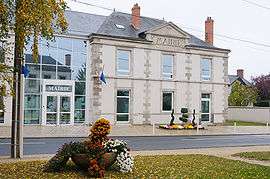
The town hall in Traînou | ||
| ||
 Traînou | ||
|
Location within Centre-Val de Loire region 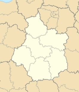 Traînou | ||
| Coordinates: 47°58′26″N 2°06′20″E / 47.9739°N 2.1056°ECoordinates: 47°58′26″N 2°06′20″E / 47.9739°N 2.1056°E | ||
| Country | France | |
| Region | Centre-Val de Loire | |
| Department | Loiret | |
| Arrondissement | Orléans | |
| Canton | Neuville-aux-Bois | |
| Government | ||
| • Mayor (2008–2014) | Michel Pothain | |
| Area1 | 33.68 km2 (13.00 sq mi) | |
| Population (2012)2 | 3,195 | |
| • Density | 95/km2 (250/sq mi) | |
| Time zone | CET (UTC+1) | |
| • Summer (DST) | CEST (UTC+2) | |
| INSEE/Postal code | 45327 / 45470 | |
| Elevation | 107–144 m (351–472 ft) | |
| Website | www.mairie-trainou.fr | |
|
1 French Land Register data, which excludes lakes, ponds, glaciers > 1 km² (0.386 sq mi or 247 acres) and river estuaries. 2 Population without double counting: residents of multiple communes (e.g., students and military personnel) only counted once. | ||
.svg.png)
Traînou is a commune in the Loiret department in north-central France.
See also
References
| Wikimedia Commons has media related to Traînou. |
This article is issued from Wikipedia - version of the 2/11/2016. The text is available under the Creative Commons Attribution/Share Alike but additional terms may apply for the media files.