Gačnik
| Gačnik | |
|---|---|
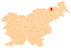
 Gačnik Location in Slovenia | |
| Coordinates: 46°37′49.03″N 15°40′50.98″E / 46.6302861°N 15.6808278°ECoordinates: 46°37′49.03″N 15°40′50.98″E / 46.6302861°N 15.6808278°E | |
| Country |
|
| Traditional region | Styria |
| Statistical region | Drava |
| Municipality | Pesnica |
| Area | |
| • Total | 4.79 km2 (1.85 sq mi) |
| Elevation | 301.9 m (990.5 ft) |
| Population (2002) | |
| • Total | 492 |
| [1] | |
Gačnik (pronounced [ˈɡaːtʃnik]) is a settlement in the Municipality of Pesnica in northeastern Slovenia. It lies in the western part of the Slovene Hills (Slovene: Slovenske gorice) in the valley of Gačnik Creek (Slovene: Gačniški potok), a minor tributary of the Pesnica River. The area was part of the traditional region of Styria. It is now included in the Drava Statistical Region.[2]
A small roadside chapel-shrine in the settlement dates to 1803.[3]
References
- ↑ Statistical Office of the Republic of Slovenia Archived November 18, 2008, at the Wayback Machine.
- ↑ Pesnica municipal site
- ↑ Slovenian Ministry of Culture register of national heritage Archived July 12, 2010, at the Wayback Machine. reference number ešd 7775
External links
| Settlements | Administrative centre: Pesnica pri Mariboru
|  |
|---|---|---|
| Landmarks |
| |
This article is issued from Wikipedia - version of the 11/13/2016. The text is available under the Creative Commons Attribution/Share Alike but additional terms may apply for the media files.