Gamay, Northern Samar
| Gamay | ||
|---|---|---|
| Municipality | ||
| ||
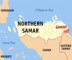 Map of Northern Samar with Gamay highlighted | ||
.svg.png) Gamay Location within the Philippines | ||
| Coordinates: 12°23′N 125°18′E / 12.383°N 125.300°ECoordinates: 12°23′N 125°18′E / 12.383°N 125.300°E | ||
| Country | Philippines | |
| Region | Eastern Visayas (Region VIII) | |
| Province | Northern Samar | |
| Congr. district | District of N. Samar | |
| Barangays | 26 | |
| Government[1] | ||
| • Type | Mayor-Council | |
| • Mayor | Henry Gomba | |
| • Vice-Mayor | Tim Capoquian | |
| Area[2] | ||
| • Total | 115.10 km2 (44.44 sq mi) | |
| Population (2010)[3] | ||
| • Total | 22,425 | |
| • Density | 190/km2 (500/sq mi) | |
| Time zone | PST (UTC+8) | |
| ZIP code | 6422 | |
| Dialing code | 55 | |

Gamay is a municipality in the province of Northern Samar, Philippines. In the east, it is bounded by the Pacific Ocean, in the south by Lapinig, in the north-west by Mapanas and Catubig. According to the 2010 census, it has a population of 22,425 people.[3]
Barangays
Gamay is politically subdivided into 26 barangays.[2]
- Anito
- Bangon
- Bato
- Baybay (Pob.)
- Bonifacio
- Burabod (Pob.)
- Cabarasan
- Cadac-an (Calingnan)
- Cade-an
- Cagamutan del Norte
- Cagamutan del Sur
- Central (Pob.)
- Dao
- G. M. Osias
- Guibuangan
- Henogawe
- Libertad (Pob.)
- Lonoy
- Luneta
- Malidong
- Occidental I (Pob.)
- Occidental II (Pob.)
- Oriental I (Pob.)
- Oriental II (Pob.)
- Rizal
- San Antonio
Demographics
| Population census of Gamay | ||
|---|---|---|
| Year | Pop. | ±% p.a. |
| 1990 | 15,764 | — |
| 1995 | 18,511 | +3.06% |
| 2000 | 20,490 | +2.20% |
| 2007 | 21,537 | +0.69% |
| 2010 | 22,425 | +1.48% |
| Source: National Statistics Office[3][4] | ||
References
- ↑ "Municipalities". Quezon City, Philippines: Department of the Interior and Local Government. Retrieved 22 April 2013.
- 1 2 "Province: Northern Samar". PSGC Interactive. Makati City, Philippines: National Statistical Coordination Board. Retrieved 22 April 2013.
- 1 2 3 "Total Population by Province, City, Municipality and Barangay: as of May 1, 2010" (PDF). 2010 Census of Population and Housing. National Statistics Office. Retrieved 22 April 2013.
- ↑ "Province of Northern Samar". Municipality Population Data. LWUA Research Division. Retrieved 20 August 2013.
External links
- Philippine Standard Geographic Code
- Philippine Census Information
- Local Governance Performance Management System
 |
Mapanas | | ||
| Catubig | |
Philippine Sea | ||
| ||||
| | ||||
| Jipapad, Eastern Samar | Lapinig |
Catarman (capital) | |
| Municipalities | |
This article is issued from Wikipedia - version of the 7/8/2016. The text is available under the Creative Commons Attribution/Share Alike but additional terms may apply for the media files.