Gröden
This article is about the municipality of Germany. For the valley in South Tyrol, see Val Gardena.
| Gröden | ||
|---|---|---|
|
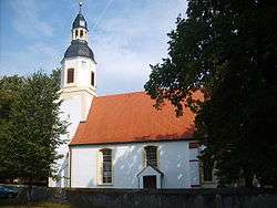
Church in Gröden | ||
| ||
 Gröden | ||
Location of Gröden within Elbe-Elster district 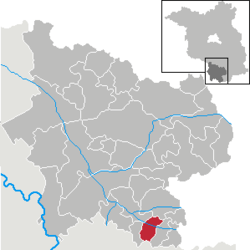 | ||
| Coordinates: 51°23′59″N 13°34′00″E / 51.39972°N 13.56667°ECoordinates: 51°23′59″N 13°34′00″E / 51.39972°N 13.56667°E | ||
| Country | Germany | |
| State | Brandenburg | |
| District | Elbe-Elster | |
| Municipal assoc. | Schradenland | |
| Government | ||
| • Mayor | Claus Voigt (Ind.) | |
| Area | ||
| • Total | 22.14 km2 (8.55 sq mi) | |
| Population (2015-12-31)[1] | ||
| • Total | 1,373 | |
| • Density | 62/km2 (160/sq mi) | |
| Time zone | CET/CEST (UTC+1/+2) | |
| Postal codes | 04932 | |
| Dialling codes | 035343 | |
| Vehicle registration | EE | |
| Website | www.gemeinde-groeden.de | |

Gröden is a municipality in the Elbe-Elster district, in Brandenburg, Germany.
Demography
.pdf.jpg) Development of Population since 1875 within the Current Boundaries (Blue Line: Population; Dotted Line: Comparison to Population Development of Brandenburg state; Grey Background: Time of Nazi rule; Red Background: Time of Communist rule)
Development of Population since 1875 within the Current Boundaries (Blue Line: Population; Dotted Line: Comparison to Population Development of Brandenburg state; Grey Background: Time of Nazi rule; Red Background: Time of Communist rule)
|
|
|
|
Detailed data sources are to be found in the Wikimedia Commons.[3]
References
- ↑ "Bevölkerung im Land Brandenburg nach amtsfreien Gemeinden, Ämtern und Gemeinden 31. Dezember 2015 (Fortgeschriebene amtliche Einwohnerzahlen auf Grundlage des Zensus 2011)". Amt für Statistik Berlin-Brandenburg (in German). 2016.
- ↑ Boundaries as of 2013
- ↑ Population Projection Brandenburg at Wikimedia Commons
This article is issued from Wikipedia - version of the 6/21/2016. The text is available under the Creative Commons Attribution/Share Alike but additional terms may apply for the media files.