Black Fell (Pennines)
| Black Fell | |
|---|---|
 | |
| Highest point | |
| Elevation | 664 m (2,178 ft) |
| Prominence | 89 m (292 ft) |
| Parent peak | Cross Fell |
| Listing | Hewitt, Nuttall |
| Geography | |
| Location | Cumbria, England |
| Parent range | North Pennines |
| OS grid | NY648444 |
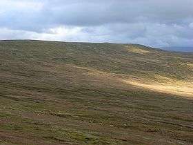
Black Fell is a hill in the North Pennines, England. It is located just north of the A686 road, west of Alston and is one of the most northerly parts of the Pennines.
Coordinates: 54°47′36″N 2°32′56″W / 54.79324°N 2.54897°W
This article is issued from Wikipedia - version of the 8/11/2016. The text is available under the Creative Commons Attribution/Share Alike but additional terms may apply for the media files.