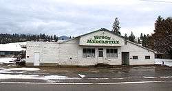
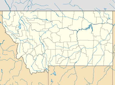
Huson, Montana
| Huson, Montana | |
|---|---|
| Census-designated place & Unincorporated community | |
 | |
 Huson, Montana  Huson, Montana | |
| Coordinates: 47°01′53″N 114°19′38″W / 47.03139°N 114.32722°WCoordinates: 47°01′53″N 114°19′38″W / 47.03139°N 114.32722°W | |
| Country | United States |
| State | Montana |
| County | Missoula |
| Area[1] | |
| • Total | 0.737 sq mi (1.91 km2) |
| • Land | 0.736 sq mi (1.91 km2) |
| • Water | 0.001 sq mi (0.003 km2) |
| Elevation | 3,012 ft (918 m) |
| Population (2010)[2] | |
| • Total | 210 |
| • Density | 280/sq mi (110/km2) |
| Time zone | Mountain (MST) (UTC-7) |
| • Summer (DST) | MDT (UTC-6) |
| ZIP code | 59846[3] |
| Area code(s) | 406 |
| GNIS feature ID | 785180[4] |
Huson is a census-designated place and unincorporated community in Missoula County, Montana, United States. Its population was 210 as of the 2010 census.[2] The community is located along Interstate 90 19 miles (31 km) northwest of Missoula.
References
- ↑ "US Gazetteer files: 2010, 2000, and 1990". United States Census Bureau. 2011-02-12. Retrieved 2011-04-23.
- 1 2 "American FactFinder". United States Census Bureau. Retrieved 2011-05-14.
- ↑ United States Postal Service (2012). "USPS - Look Up a ZIP Code". Retrieved 2012-02-15.
- ↑ "Huson". Geographic Names Information System. United States Geological Survey.
Municipalities and communities of Missoula County, Montana, United States | ||
|---|---|---|
| City | 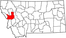 | |
| CDPs | ||
| Unincorporated communities | ||
| Ghost towns | ||
| Indian reservation | ||
| Footnotes | ‡This populated place also has portions in an adjacent county or counties | |
This article is issued from Wikipedia - version of the 8/8/2016. The text is available under the Creative Commons Attribution/Share Alike but additional terms may apply for the media files.