Iracemápolis
| Iracemápolis | |||
|---|---|---|---|
| Municipality | |||
| |||
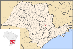 Location in São Paulo state | |||
 Iracemápolis Location in Brazil | |||
| Coordinates: 22°34′50″S 47°31′07″W / 22.58056°S 47.51861°WCoordinates: 22°34′50″S 47°31′07″W / 22.58056°S 47.51861°W | |||
| Country |
| ||
| Region | Southeast Region | ||
| State | São Paulo | ||
| Mesoregion | Piracicaba | ||
| Microregion | Limeira | ||
| Area | |||
| • Total | 115.1 km2 (44.4 sq mi) | ||
| Elevation | 608 m (1,995 ft) | ||
| Population (2015) | |||
| • Total | 22,557 | ||
| • Density | 200/km2 (510/sq mi) | ||
| Time zone | BRT/BRST (UTC-3/-2) | ||
| Website |
iracemapolis | ||


Iracemápolis is a municipality in the state of São Paulo in Brazil. The population is 22,557 (2015 est.) in an area of 115.1 km².[1] The elevation is 608 m.
It is well known as the birthplace of footballer Elano.
References
This article is issued from Wikipedia - version of the 10/6/2016. The text is available under the Creative Commons Attribution/Share Alike but additional terms may apply for the media files.