Iracema, Roraima
For other uses, see Iracema.
| Iracema | |
|---|---|
| Municipality | |
 Iracema Location in Brazil | |
| Coordinates: 2°10′55″N 61°2′27″W / 2.18194°N 61.04083°WCoordinates: 2°10′55″N 61°2′27″W / 2.18194°N 61.04083°W | |
| Country |
|
| Region | North Region |
| State | Roraima |
| Area | |
| • Total | 14,413 km2 (5,565 sq mi) |
| Population (2015) | |
| • Total | 10,320 |
| • Density | 0.72/km2 (1.9/sq mi) |
| Time zone | BRT-1 (UTC-4) |
Iracema is a municipality located in the midwest of the state of Roraima in Brazil. Its population is 10,320 (2015) and its area is 14,413 km².[1]
References
- ↑ "IBGE | Cidades | Roraima | Iracema". cidades.ibge.gov.br. Retrieved 2016-06-15.
Capital: Boa Vista | ||
| Boa Vista | 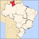 | |
| Nordeste de Roraima | ||
| Caracarai | ||
| Sudeste de Roraima | ||
This article is issued from Wikipedia - version of the 6/15/2016. The text is available under the Creative Commons Attribution/Share Alike but additional terms may apply for the media files.