Isoma, Achaea
For other uses, see Isoma (disambiguation).
| Isoma Ίσωμα | |
|---|---|
 | |
 Isoma | |
| Coordinates: 38°6′N 21°42′E / 38.100°N 21.700°ECoordinates: 38°6′N 21°42′E / 38.100°N 21.700°E | |
| Country | Greece |
| Administrative region | West Greece |
| Regional unit | Achaea |
| Municipality | Erymanthos |
| Municipal unit | Farres |
| Highest elevation | 120 m (390 ft) |
| Lowest elevation | 100 m (300 ft) |
| Population (2011)[1] | |
| • Rural | 452 |
| Time zone | EET (UTC+2) |
| • Summer (DST) | EEST (UTC+3) |
| Postal code | 252 00 |
| Area code(s) | 26240 |
| Vehicle registration | AX |
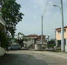
Isoma (Greek: Ίσωμα) is a village in the municipal unit of Farres, Achaea, Greece. It is 2 km northwest of Fares and 16 km south of Patras. Isoma had a population of 452 in 2011. Isoma is situated in the plain between the rivers Peiros and Tythefs.
Population
| Year | Population |
|---|---|
| 1981 | 531 |
| 1991 | 509 |
| 2001 | 539 |
| 2011 | 452 |
See also
References
- ↑ "Απογραφή Πληθυσμού - Κατοικιών 2011. ΜΟΝΙΜΟΣ Πληθυσμός" (in Greek). Hellenic Statistical Authority.
External links
This article is issued from Wikipedia - version of the 10/14/2016. The text is available under the Creative Commons Attribution/Share Alike but additional terms may apply for the media files.