Ješovec pri Šmarju
| Ješovec pri Šmarju | |
|---|---|
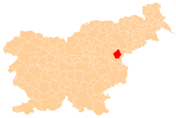
 Ješovec pri Šmarju Location in Slovenia | |
| Coordinates: 46°12′54.16″N 15°30′50.54″E / 46.2150444°N 15.5140389°ECoordinates: 46°12′54.16″N 15°30′50.54″E / 46.2150444°N 15.5140389°E | |
| Country |
|
| Traditional region | Styria |
| Statistical region | Savinja |
| Municipality | Šmarje pri Jelšah |
| Area | |
| • Total | 0.4 km2 (0.2 sq mi) |
| Elevation | 357 m (1,171 ft) |
| Population (2002) | |
| • Total | 54 |
| [1] | |
Ješovec pri Šmarju (pronounced [jɛˈʃɔːʋəts pɾi ˈʃmaːɾju] or [jɛˈʃoːʋəts pɾi ˈʃmaːɾju]) is a small settlement in the Municipality of Šmarje pri Jelšah in eastern Slovenia. It is a roadside settlement on the road leading into the hills to the south of Šmarje. The area was traditionally part of Styria and is now included in the Savinja Statistical Region.[2]
Name
The name of the settlement was changed from Ješovec to Ješovec pri Šmarju in 1953.[3]
References
- ↑ Statistical Office of the Republic of Slovenia Archived November 18, 2008, at the Wayback Machine.
- ↑ Šmarje pri Jelšah municipal site
- ↑ Spremembe naselij 1948–95. 1996. Database. Ljubljana: Geografski inštitut ZRC SAZU, DZS.
External links
This article is issued from Wikipedia - version of the 11/13/2016. The text is available under the Creative Commons Attribution/Share Alike but additional terms may apply for the media files.