Klondike, Indiana
| Klondike | |
|---|---|
| Unincorporated community | |
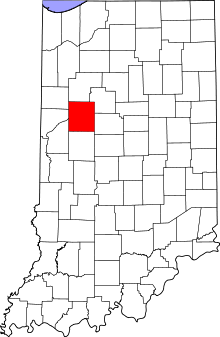 Tippecanoe County's location in Indiana | |
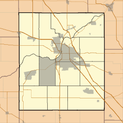 Klondike Location in Tippecanoe County | |
| Coordinates: 40°28′03″N 86°57′44″W / 40.46750°N 86.96222°W | |
| Country | United States |
| State | Indiana |
| County | Tippecanoe |
| Township | Wabash |
| Elevation[1] | 659 ft (201 m) |
| Time zone | EST (UTC-5) |
| • Summer (DST) | EDT (UTC-4) |
| ZIP code | 47906 |
| Area code(s) | 765 |
| GNIS feature ID | 437378 |
Klondike is an unincorporated community in Wabash Township, Tippecanoe County, in the U.S. state of Indiana.[2]
The community is part of the Lafayette, Indiana Metropolitan Statistical Area.
History
A post office was established at Klondike in 1897, and remained in operation until it was discontinued in 1900.[3]
Geography
Klondike is located at 40°28′03″N 86°57′44″W / 40.46750°N 86.96222°W with an elevation of 709 feet.
References
- ↑ "US Board on Geographic Names". United States Geological Survey. 2007-10-25. Retrieved 2008-01-31.
- ↑ "Klondike, Tippecanoe County, Indiana". Geographic Names Information System. United States Geological Survey. Retrieved 2016-07-26.
- ↑ "Tippecanoe County". Jim Forte Postal History. Retrieved July 25, 2016.
Municipalities and communities of Tippecanoe County, Indiana, United States | ||
|---|---|---|
| Cities | ||
| Towns | ||
| Townships | ||
| CDPs | ||
| Other unincorporated communities |
| |
| Ghost towns | ||
| Footnotes | ‡This populated place also has portions in an adjacent county or counties | |
This article is issued from Wikipedia - version of the 7/27/2016. The text is available under the Creative Commons Attribution/Share Alike but additional terms may apply for the media files.