Kumberg
| Kumberg | ||
|---|---|---|
| ||
 Kumberg Location within Austria | ||
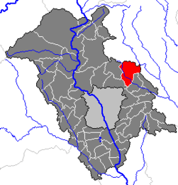
Location within Graz-Umgebung district
| ||
| Coordinates: 47°09′34″N 15°32′03″E / 47.15944°N 15.53417°ECoordinates: 47°09′34″N 15°32′03″E / 47.15944°N 15.53417°E | ||
| Country | Austria | |
| State | Styria | |
| District | Graz-Umgebung | |
| Government | ||
| • Mayor | Franz Gruber (ÖVP) | |
| Area | ||
| • Total | 29.27 km2 (11.30 sq mi) | |
| Elevation | 526 m (1,726 ft) | |
| Population (1 January 2016)[1] | ||
| • Total | 3,814 | |
| • Density | 130/km2 (340/sq mi) | |
| Time zone | CET (UTC+1) | |
| • Summer (DST) | CEST (UTC+2) | |
| Postal code | 8062 | |
| Area code | 03132 | |
| Vehicle registration | GU | |
| Website | www.kumberg.at | |

Kumberg is a municipality in the district of Graz-Umgebung in the Austrian state of Styria.
Population
| Historical population | ||
|---|---|---|
| Year | Pop. | ±% |
| 1869 | 1,770 | — |
| 1880 | 1,829 | +3.3% |
| 1890 | 1,871 | +2.3% |
| 1900 | 1,971 | +5.3% |
| 1910 | 1,939 | −1.6% |
| 1923 | 1,944 | +0.3% |
| 1934 | 2,014 | +3.6% |
| 1939 | 1,956 | −2.9% |
| 1951 | 1,999 | +2.2% |
| 1961 | 2,054 | +2.8% |
| 1971 | 2,273 | +10.7% |
| 1981 | 2,373 | +4.4% |
| 1991 | 2,716 | +14.5% |
| 2001 | 3,067 | +12.9% |
| 2011 | 3,569 | +16.4% |
References
This article is issued from Wikipedia - version of the 12/12/2013. The text is available under the Creative Commons Attribution/Share Alike but additional terms may apply for the media files.