Weinitzen
| Weinitzen | ||
|---|---|---|
| ||
 Weinitzen Location within Austria | ||
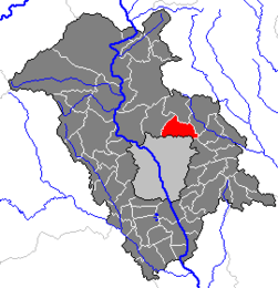
Location within Graz-Umgebung district
| ||
| Coordinates: 47°08′27″N 15°29′26″E / 47.14083°N 15.49056°ECoordinates: 47°08′27″N 15°29′26″E / 47.14083°N 15.49056°E | ||
| Country | Austria | |
| State | Styria | |
| District | Graz-Umgebung | |
| Government | ||
| • Mayor | Hans Werner Tüchler | |
| Area | ||
| • Total | 18.94 km2 (7.31 sq mi) | |
| Elevation | 510 m (1,670 ft) | |
| Population (1 January 2016)[1] | ||
| • Total | 2,638 | |
| • Density | 140/km2 (360/sq mi) | |
| Time zone | CET (UTC+1) | |
| • Summer (DST) | CEST (UTC+2) | |
| Postal code | 8044 | |
| Area code | 03132 | |
| Vehicle registration | GU | |
| Website | www.weinitzen.com | |

Weinitzen is a municipality in the district of Graz-Umgebung in the Austrian state of Styria.
Population
| Historical population | ||
|---|---|---|
| Year | Pop. | ±% |
| 1869 | 877 | — |
| 1880 | 862 | −1.7% |
| 1890 | 895 | +3.8% |
| 1900 | 900 | +0.6% |
| 1910 | 909 | +1.0% |
| 1923 | 869 | −4.4% |
| 1934 | 982 | +13.0% |
| 1939 | 1,031 | +5.0% |
| 1951 | 1,115 | +8.1% |
| 1961 | 1,162 | +4.2% |
| 1971 | 1,456 | +25.3% |
| 1981 | 1,874 | +28.7% |
| 1991 | 2,224 | +18.7% |
| 2001 | 2,424 | +9.0% |
References
This article is issued from Wikipedia - version of the 12/12/2013. The text is available under the Creative Commons Attribution/Share Alike but additional terms may apply for the media files.