Lac-Saint-Jean-Est Regional County Municipality
| Lac-Saint-Jean-Est | |
|---|---|
| Regional county municipality | |
 | |
| Coordinates: 48°33′N 71°39′W / 48.550°N 71.650°WCoordinates: 48°33′N 71°39′W / 48.550°N 71.650°W[1] | |
| Country |
|
| Province |
|
| Region | Saguenay–Lac-Saint-Jean |
| Effective | January 1, 1982 |
| County seat | Alma |
| Government[2] | |
| • Type | Prefecture |
| • Prefect | André Paradis |
| Area[2][3] | |
| • Total | 2,917.10 km2 (1,126.30 sq mi) |
| • Land | 2,781.44 km2 (1,073.92 sq mi) |
| Population (2011)[3] | |
| • Total | 52,520 |
| • Density | 18.9/km2 (49/sq mi) |
| • Pop 2006-2011 |
|
| • Dwellings | 24,653 |
| Time zone | EST (UTC−5) |
| • Summer (DST) | EDT (UTC−4) |
| Area code(s) | 418 and 581 |
| Website |
www |
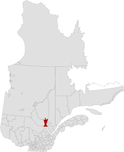
Lac-Saint-Jean-Est is a regional county municipality in the Saguenay–Lac-Saint-Jean region of Quebec, Canada. The seat is Alma. In 2006 it was 99.5% French-speaking.
Subdivisions
There are 18 subdivisions within the RCM:[2]
|
|
|
|
|
Demographics
Population
| Canada census – Lac-Saint-Jean-Est Regional County Municipality community profile | |||
|---|---|---|---|
| 2011 | 2006 | 2001 | |
| Population: | 52,520 (+2.6% from 2006) | 51,170 (-1.1% from 2001) | 51,760 (-1.2% from 1996) |
| Land area: | 2,781.44 km2 (1,073.92 sq mi) | 2,781.44 km2 (1,073.92 sq mi) | 2,781.52 km2 (1,073.95 sq mi) |
| Population density: | 18.9/km2 (49/sq mi) | 18.4/km2 (48/sq mi) | 18.6/km2 (48/sq mi) |
| Median age: | 45.3 (M: 44.2, F: 46.2) | 42.7 (M: 42.1, F: 43.4) | 39.0 (M: 38.4, F: 39.8) |
| Total private dwellings: | 24,653 | 23,180 | 20,367 |
| Median household income: | $52,048 | $46,291 | $40,484 |
| References: 2011[3] 2006[4] 2001[5] | |||
| Historical Census Data - Lac-Saint-Jean-Est Regional County Municipality, Quebec[6] | ||||||||||||||||||||||||||
|---|---|---|---|---|---|---|---|---|---|---|---|---|---|---|---|---|---|---|---|---|---|---|---|---|---|---|
|
|
| ||||||||||||||||||||||||
Language
| Canada Census Mother Tongue - Lac-Saint-Jean-Est Regional County Municipality, Quebec[6] | ||||||||||||||||||
|---|---|---|---|---|---|---|---|---|---|---|---|---|---|---|---|---|---|---|
| Census | Total | French |
English |
French & English |
Other | |||||||||||||
| Year | Responses | Count | Trend | Pop % | Count | Trend | Pop % | Count | Trend | Pop % | Count | Trend | Pop % | |||||
| 2011 |
51,835 |
51,365 | |
99.09% | 230 | |
0.44% | 85 | |
0.16% | 155 | |
0.30% | |||||
| 2006 |
50,630 |
50,000 | |
98.76% | 185 | |
0.37% | 45 | |
0.08% | 400 | |
0.79% | |||||
| 2001 |
50,935 |
50,490 | |
99.13% | 220 | |
0.43% | 110 | |
0.22% | 115 | |
0.23% | |||||
| 1996 |
51,685 |
51,310 | n/a | 99.27% | 195 | n/a | 0.38% | 85 | n/a | 0.16% | 95 | n/a | 0.18% | |||||
Transportation
Access Routes
Highways and numbered routes that run through the municipality, including external routes that start or finish at the county border:[7]
|
|
|
|
See also
References
- ↑ Reference number 141098 of the Commission de toponymie du Québec (French)
- 1 2 3 Ministère des Affaires municipales, des Régions et de l'Occupation du territoire: Lac-Saint-Jean-Est Regional County Municipality
- 1 2 3 2011 Statistics Canada Census Profile: Lac-Saint-Jean-Est Regional County Municipality, Quebec
- ↑ "2006 Community Profiles". Canada 2006 Census. Statistics Canada. March 30, 2011. Retrieved 2014-03-09.
- ↑ "2001 Community Profiles". Canada 2001 Census. Statistics Canada. February 17, 2012. Retrieved 2014-03-09.
- 1 2 Statistics Canada: 1996, 2001, 2006, 2011 census
- ↑ Official Transport Quebec Road Map
 |
Maria-Chapdelaine RCM | | ||
| Le Domaine-du-Roy RCM | |
Le Fjord-du-Saguenay RCM Saguenay TE | ||
| ||||
| | ||||
| La Tuque TE | La Côte-de-Beaupré RCM | Charlevoix RCM |
This article is issued from Wikipedia - version of the 4/12/2014. The text is available under the Creative Commons Attribution/Share Alike but additional terms may apply for the media files.