Lage, North Rhine-Westphalia
| Lage | ||
|---|---|---|
|
Market square | ||
| ||
 Lage | ||
Location of Lage within Lippe district 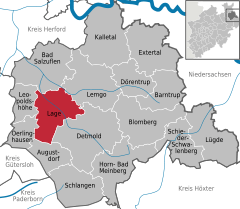
 | ||
| Coordinates: 51°58′0″N 8°48′0″E / 51.96667°N 8.80000°ECoordinates: 51°58′0″N 8°48′0″E / 51.96667°N 8.80000°E | ||
| Country | Germany | |
| State | North Rhine-Westphalia | |
| Admin. region | Detmold | |
| District | Lippe | |
| Government | ||
| • Mayor | Christian Liebrecht (CDU) | |
| Area | ||
| • Total | 76.04 km2 (29.36 sq mi) | |
| Population (2015-12-31)[1] | ||
| • Total | 35,120 | |
| • Density | 460/km2 (1,200/sq mi) | |
| Time zone | CET/CEST (UTC+1/+2) | |
| Postal codes | 32779–32791 | |
| Dialling codes | 05232 | |
| Vehicle registration | LIP | |
| Website | www.lage.de | |
.jpg)

Lage is a town in the Lippe district of North Rhine-Westphalia (German: Nordrhein-Westfalen), Germany, approximatively 8 km northwest of Detmold. It has c. 34,700 inhabitants (2013). The coat of arms of Lage depicts a farmer's plough. The town is not far from the Teutoburg Forest (German: Teutoburger Wald).
The town is twinned with Horsham in the United Kingdom.
References
- ↑ "Amtliche Bevölkerungszahlen". Landesbetrieb Information und Technik NRW (in German). 18 July 2016.
External links
- Official website (German)
Towns and municipalities in Lippe | ||
|---|---|---|
This article is issued from Wikipedia - version of the 8/23/2015. The text is available under the Creative Commons Attribution/Share Alike but additional terms may apply for the media files.