Langisjór
| Langisjór | |
|---|---|
 in summer | |
| Coordinates | 64°11′N 18°15′W / 64.183°N 18.250°WCoordinates: 64°11′N 18°15′W / 64.183°N 18.250°W |
| Basin countries | Iceland |
| Max. length | 20 km |
| Max. width | 2 km |
| Surface area | 26 km² |
| Max. depth | 75 m |
| Surface elevation | 670 m |
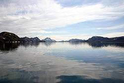
Langisjór is a lake in the Highlands of Iceland. It is around 20 km in length and up to 2 km wide, with a total surface area of about 26 km² and a depth of 75m at its deepest point.
The lake is situated rather far from civilisation at the south-western border of Vatnajökull at an altitude of 670 m above sea level. Environmental campaigners have expressed concern at government plans to site an industrial dam on the lake.
See also
References
External links
This article is issued from Wikipedia - version of the 4/23/2016. The text is available under the Creative Commons Attribution/Share Alike but additional terms may apply for the media files.