Les Bons Villers
| Les Bons Villers | |||
|---|---|---|---|
| Municipality | |||
|
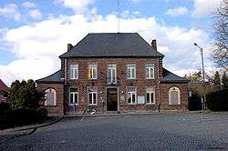
Town hall | |||
| |||
 Les Bons Villers Location in Belgium | |||
|
Location of Les Bons Villers in Hainaut 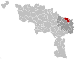 | |||
| Coordinates: 50°32′N 04°27′E / 50.533°N 4.450°ECoordinates: 50°32′N 04°27′E / 50.533°N 4.450°E | |||
| Country | Belgium | ||
| Community | French Community | ||
| Region | Wallonia | ||
| Province | Hainaut | ||
| Arrondissement | Charleroi | ||
| Government | |||
| • Mayor | Emmanuel Wart (MR-IC) | ||
| • Governing party/ies | MR-IC, PS | ||
| Area | |||
| • Total | 42.55 km2 (16.43 sq mi) | ||
| Population (1 January 2016)[1] | |||
| • Total | 9,367 | ||
| • Density | 220/km2 (570/sq mi) | ||
| Postal codes | 6210-6211 | ||
| Area codes | 071 | ||
| Website | www.les-bons-villers.be | ||


Les Bons Villers is a Walloon municipality located in the Belgian province of Hainaut. On 1 January 2006 the municipality had 8,860 inhabitants. The total area is 42.55 km², giving a population density of 208 inhabitants per km².
The town was formed in 1977 through the merger of five previously autonomous villages: Frasnes-lez-Gosselies, Mellet, Rèves, Villers-Perwin and Wayaux.
References
- ↑ Population per municipality as of 1 January 2016 (XLS; 397 KB)
External links
-
 Media related to Les Bons Villers at Wikimedia Commons
 |
Nivelles (WBR) | Genappe (WBR) | Villers-la-Ville (WBR) | |
| Pont-à-Celles | |
Fleurus | ||
| ||||
| | ||||
| Charleroi |
This article is issued from Wikipedia - version of the 12/1/2016. The text is available under the Creative Commons Attribution/Share Alike but additional terms may apply for the media files.