List of United Kingdom locations: East M-East Y
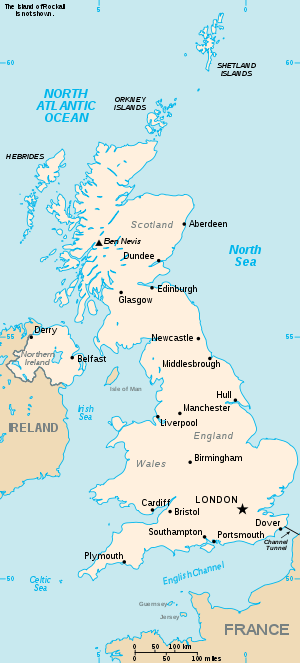
The United Kingdom
This is part of the list of United Kingdom locations: a gazetteer of place names in the United Kingdom showing each place's locality and geographical coordinates.
East M
East N
| Location | Locality | Coordinates (links to map & photo sources) |
OS grid reference |
| East Ness | North Yorkshire | 54°11′N 0°56′W / 54.19°N 00.94°W | SE6978 |
| East Nevay | Angus | 56°35′N 3°05′W / 56.58°N 03.09°W | NO3344 |
| East Newton | East Riding of Yorkshire | 53°49′N 0°05′W / 53.81°N 00.08°W | TA2637 |
| East Newton | North Yorkshire | 54°12′N 1°01′W / 54.20°N 01.02°W | SE6479 |
| Eastney | City of Portsmouth | 50°47′N 1°04′W / 50.78°N 01.06°W | SZ6699 |
| Eastnor | Herefordshire | 52°02′N 2°23′W / 52.03°N 02.39°W | SO7337 |
| East Norton | Leicestershire | 52°35′N 0°50′W / 52.59°N 00.84°W | SK7800 |
| East Nynehead | Somerset | 50°59′N 3°13′W / 50.99°N 03.21°W | ST1522 |
East O
East P
| Location | Locality | Coordinates (links to map & photo sources) |
OS grid reference |
| East Panson | Devon | 50°42′N 4°19′W / 50.70°N 04.32°W | SX3692 |
| East Parley | Dorset | 50°46′N 1°51′W / 50.77°N 01.85°W | SZ1097 |
| East Peckham | Kent | 51°12′N 0°22′E / 51.20°N 00.37°E | TQ6648 |
| East Pennard | Somerset | 51°08′N 2°35′W / 51.13°N 02.58°W | ST5937 |
| East Perry | Cambridgeshire | 52°17′N 0°19′W / 52.28°N 00.31°W | TL1566 |
| East Portlemouth | Devon | 50°13′N 3°46′W / 50.22°N 03.76°W | SX7438 |
| East Prawle | Devon | 50°13′N 3°43′W / 50.21°N 03.71°W | SX7836 |
| East Preston | West Sussex | 50°48′N 0°29′W / 50.80°N 00.48°W | TQ0702 |
| East Preston | Dumfries and Galloway | 54°53′N 3°37′W / 54.88°N 03.62°W | NX9656 |
| East Pulham | Dorset | 50°52′N 2°23′W / 50.87°N 02.39°W | ST7209 |
| East Putford | Devon | 50°55′N 4°20′W / 50.92°N 04.33°W | SS3616 |
East Q
| Location | Locality | Coordinates (links to map & photo sources) |
OS grid reference |
| East Quantoxhead | Somerset | 51°10′N 3°14′W / 51.17°N 03.24°W | ST1343 |
East R
East S
East T
| Location | Locality | Coordinates (links to map & photo sources) |
OS grid reference |
| East Taphouse | Cornwall | 50°26′N 4°34′W / 50.43°N 04.56°W | SX1863 |
| East-the-Water | Devon | 51°01′N 4°11′W / 51.01°N 04.19°W | SS4626 |
| East Third | Scottish Borders | 55°37′N 2°34′W / 55.61°N 02.57°W | NT6436 |
| East Thirston | Northumberland | 55°17′N 1°42′W / 55.28°N 01.70°W | NZ1999 |
| East Tilbury | Essex | 51°28′N 0°25′E / 51.47°N 00.41°E | TQ6878 |
| East Tisted | Hampshire | 51°05′N 1°00′W / 51.08°N 01.00°W | SU7032 |
| East Torrington | Lincolnshire | 53°20′N 0°17′W / 53.33°N 00.28°W | TF1483 |
| East Town | Somerset | 51°09′N 2°34′W / 51.15°N 02.57°W | ST6040 |
| East Town | Somerset | 51°05′N 3°17′W / 51.08°N 03.28°W | ST1032 |
| East Town | Wiltshire | 51°17′N 2°09′W / 51.29°N 02.15°W | ST8955 |
| East Trewent | Pembrokeshire | 51°38′N 4°53′W / 51.63°N 04.89°W | SS0097 |
| East Tuddenham | Norfolk | 52°39′N 1°04′E / 52.65°N 01.07°E | TG0811 |
| East Tytherley | Hampshire | 51°03′N 1°35′W / 51.05°N 01.58°W | SU2928 |
| East Tytherton | Wiltshire | 51°28′N 2°03′W / 51.46°N 02.05°W | ST9674 |
East V
| Location | Locality | Coordinates (links to map & photo sources) |
OS grid reference |
| East Village | Devon | 50°50′N 3°38′W / 50.83°N 03.64°W | SS8405 |
| East Village | The Vale Of Glamorgan | 51°27′N 3°27′W / 51.45°N 03.45°W | SS9974 |
| Eastville | City of Bristol | 51°28′N 2°34′W / 51.47°N 02.56°W | ST6175 |
| Eastville | Lincolnshire | 53°05′N 0°05′E / 53.08°N 00.08°E | TF4056 |
East W
East Y
| Location | Locality | Coordinates (links to map & photo sources) |
OS grid reference |
| East Youlstone | Cornwall | 50°54′N 4°28′W / 50.90°N 04.46°W | SS2715 |
This article is issued from Wikipedia - version of the 5/2/2016. The text is available under the Creative Commons Attribution/Share Alike but additional terms may apply for the media files.