Melrose, Oregon
| Melrose, Oregon | |
|---|---|
| Census-designated place (CDP) | |
|
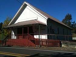
The grange hall at Melrose | |
 Melrose, Oregon  Melrose, Oregon | |
| Coordinates: 43°15′10″N 123°27′27″W / 43.2528610°N 123.4574581°WCoordinates: 43°15′10″N 123°27′27″W / 43.2528610°N 123.4574581°W | |
| Country | United States |
| State | Oregon |
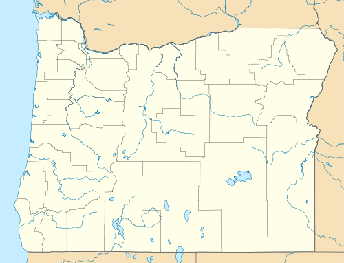
| County | Douglas |
| Area | |
| • Total | 4.4 sq mi (11.3 km2) |
| • Land | 4.4 sq mi (11.3 km2) |
| • Water | 0 sq mi (0 km2) |
| Elevation | 420 ft (128 m) |
| Population (2010) | |
| • Total | 735 |
| • Density | 170/sq mi (65/km2) |
| Time zone | Pacific (PST) (UTC-8) |
| • Summer (DST) | PDT (UTC-7) |
| ZIP code | 97471 |
| Area code(s) | 458 and 541 |
| GNIS feature ID | 1124051 |
Melrose is an unincorporated community and census-designated place in Douglas County, Oregon, United States.[1] As of the 2010 census, it had a population of 735.[2] It was named by Henry Scott for Melrose Abbey in Scotland. Its post office, at first named Hogan, was established on May 18, 1887, and James McKinney was the first postmaster.[3]
References
- ↑ "Melrose". Geographic Names Information System. United States Geological Survey. November 28, 1980. Retrieved October 23, 2011.
- ↑ "Profile of General Population and Housing Characteristics: 2010 Demographic Profile Data (DP-1): Melrose CDP, Oregon". U.S. Census Bureau, American Factfinder. Retrieved February 13, 2012.
- ↑ McArthur, Lewis A.; McArthur, Lewis L. (2003) [1928]. Oregon Geographic Names (7th ed.). Portland, Oregon: Oregon Historical Society Press. p. 635. ISBN 978-0875952772.
Municipalities and communities of Douglas County, Oregon, United States | ||
|---|---|---|
| Cities | 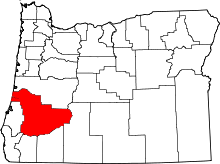 | |
| CDPs | ||
| Unincorporated communities | ||
This article is issued from Wikipedia - version of the 7/31/2016. The text is available under the Creative Commons Attribution/Share Alike but additional terms may apply for the media files.